0325L-MONDAY OUTLOOK FROM GARFIELD COUNTY EMERGENCY MANAGEMENT-3/28/22
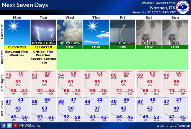
1- Warm weather continues with warmer temps and slowly increasing winds. Besides dirt and some smoke in the air, we should have a relatively nice day. A storm system will push in later on Tuesday and bring us a chance for some thunderstorm activity in which some storms could be severe. We’ll see how this comes together in later guidance.
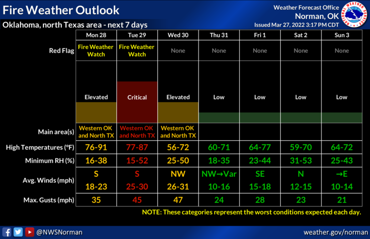
2- The Fire Danger continues so use EXTREME caution utilizing anything related to fire. There has been several fires over the weekend so just be very careful. Overall, we’ll be ok so here is your forecast from the NWS/NORMAN;
Today-Sunny. Highs in the upper 70s. East winds 10 to 15 mph, becoming south this afternoon.
Tonight-Partly cloudy in the evening, then becoming mostly cloudy. Not as cool with lows in the lower 60s. South winds 15 to 20 mph with gusts up to 30 mph.
3- GARFIELD COUNTY EM is our notification app. NWS advisories and warnings come through this app automatically along with notifications from us here at GCEM. You want to be prepared? Download our app today.
HAVE A GOOD DAY!!
THE GRAPHICS ARE FROM LATE YESTERDAY- NO NEW GRAPHICS WERE AVAILABLE AT THE TIME OF THIS POST.