0340L-TUESDAY OUTLOOK FROM GARFIELD COUNTY EMERGENCY MANAGEMENT-3/29/22
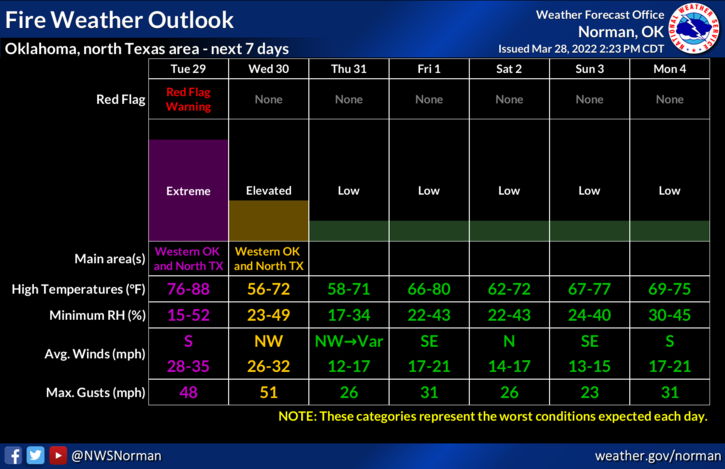
1-RED FLAG FIRE WARNING IN EFFECT FROM NOON TODAY UNTIL 9PM TONIGHT. EXTREME conditions are expected. Those conditions are high temps, very low humidity, and strong winds.
2- We are also in a WIND ADVISORY from 11 am today until 8 pm tonight. Southerly winds 20-30 mph gusting to 45mph are possible.
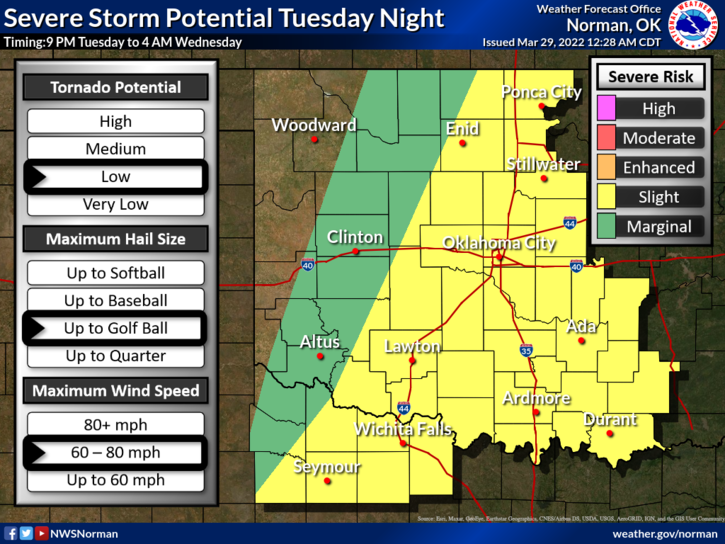
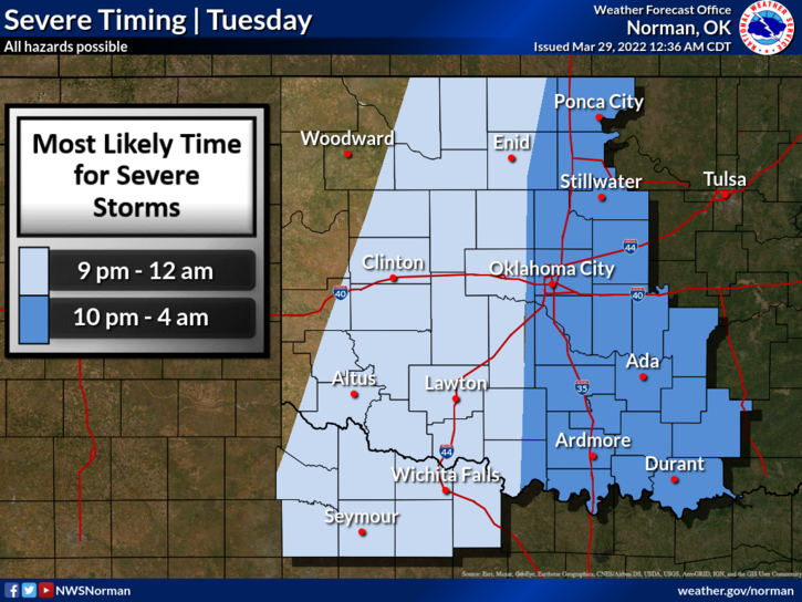
3- We also are in a SLIGHT RISK area for severe weather later this evening and overnight. Initially, ALL HAZARDS are possible as the dryline pushes east and storms form. This could occur just west of us, on top of us, or just east of us. It will all depend on how far east the dryline pushes later this afternoon and evening.
4- Without going into major detail right now, since guidance will change several times during the day, I will do a live broadcast on our emergency management page @EGCEM on facebook “around” noon. By then, we’ll have a better handle as to why, where, and when, things may occur. Remember that ANY line on the attached graphics will move some during the day as the data verifies. It is spring and we have a storm system, a dryline, and a cold front in the mix.
Finally, NO NEED TO PANIC. Just stay weather aware and we’ll get through the fire situation during the day and then the severe weather this evening and overnight.
Here is your forecast from the NWS/NORMAN;
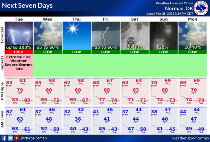
Today-Cloudy this morning, then mostly sunny with a slight chance of showers and thunderstorms this afternoon. Windy with highs in the lower 80s. South winds 20 to 30 mph with gusts up to 45 mph. Chance of rain 20 percent.
Tonight-Mostly cloudy. A chance of showers and thunderstorms, mainly in the evening. Windy, cooler with lows in the mid-40s. South winds 20 to 30 mph with gusts up to 40 mph, diminishing to 15 to 20 mph with gusts up to 30 mph after midnight. Chance of rain 50 percent.
HAVE A GOOD DAY!