0355L-MONDAY OUTLOOK &INFO FROM GARFIELD COUNTY EMERGENCY MGMT-3/30/2020
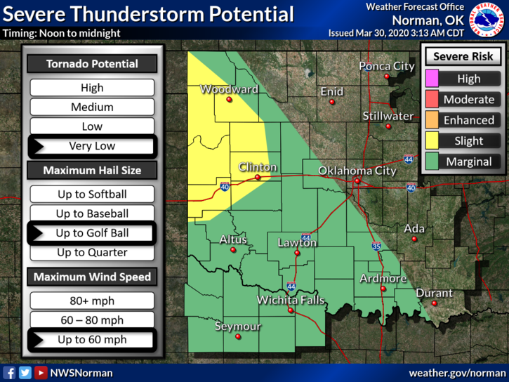
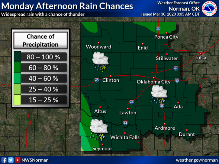
1- The clouds will be moving back in as a storm system moves in and through the area today and tonight. We are in a GENERAL THUNDERSTORM RISK area today into the overnight hours. The severe risk looks to be to our west and southwest. Rainfall could occur as early as 2pm this afternoon. Rain chances are around 70%.
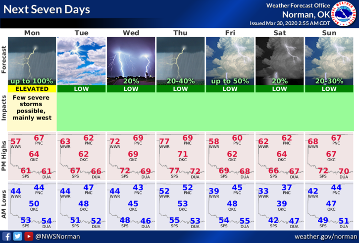
2- Here is your forecast from the NWS/NORMAN;
Today-Increasing clouds with showers and isolated thunderstorms in the afternoon. Highs in the mid-60s. Southeast winds 10 to 15 mph.
Tonight-Rain showers and isolated thunderstorms in the evening, then rain showers likely and isolated thunderstorms after midnight. Lows in the upper 40s with east winds around 10 mph shifting to the northeast after midnight.
DIRECTORS COMMENTS
There have been several comments concerning the locations where the positive COVID-19 patients live. We have small towns all around our county with many folks that are sick. Yes, we have 2 known cases right now and in my opinion, there could be more. IF Health officials stated that 1 was from a given location and the other is from another, folks in those towns would know who they are because everyone knows everyone. Then someone would post their names on social media.
HIPPA regulations are in place for a reason. If I was sick and posted that, it’s ok. If I am sick and you post that without permission, you could possibly be in trouble. Here is what I would do as we venture further into the virus situation; ASSUME ALL CASES ARE FROM YOUR CITY OR TOWN AND TAKE THE PROPER PRECAUTIONS. I know how many cases there are but we aren’t told where they live and that’s ok with me. We’re all a little nervous about this and especially those of us above age 60. Try to be patient, try to be calm, try to overcome your fear, and we’ll all get through this in time, TOGETHER.
HAVE A GREAT DAY!!
MIKE