0405L-SUNDAY OUTLOOK FROM GARFIELD COUNTY EMERGENCY MANAGEMENT-5/9/21
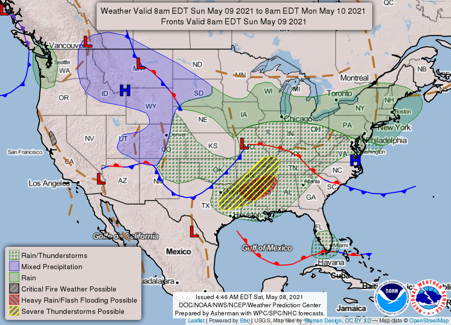
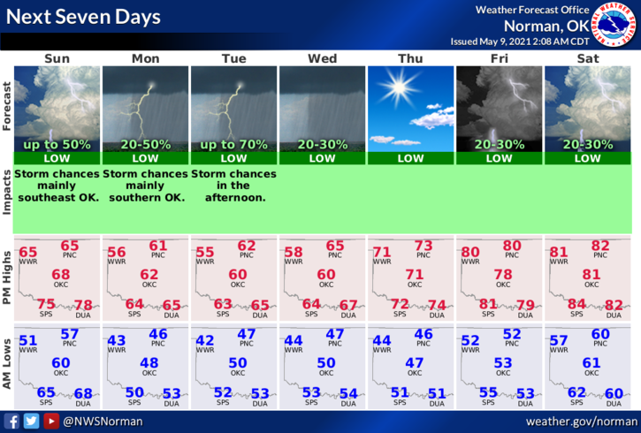
1- The front has pushed through the area with no rain, just a windshift and cooler air. Cooler temps will become the norm this week along with chances for rain each day or evening, for the most part. Overall, a cool week and colder nights meaning lows on the 40s, will be the norm. Temps should make it back into the 80s for highs by Friday or so. We’ll see what happens.
2- Reminder, the guidance I go by comes from the NWS/NORMAN and NWS/WICHITA. Here is your forecast from the NWS/NORMAN;
Today-Decreasing clouds. Cooler. Highs in the upper 60s. North winds 15 to 20 mph gusting to 30 mph.
Tonight-Partly cloudy. A chance of rain showers and isolated thunderstorms after midnight. Cooler. Lows in the mid-40s. Northeast winds 10 to 15 mph. Chance of precipitation 30 percent.
FINALLY: Be sure to download our GARFIELD COUNTY EM app. It’s a great resource and is loaded with information. NWS warnings and advisories come through it automatically so you should always be aware of what’s going on. You never know, it just might save your life!
HAVE A GOOD DAY!!
MIKE