0400L-MONDAY OUTLOOK FROM GARFIELD COUNTY EMERGENCY MANAGEMENT-5/17/21
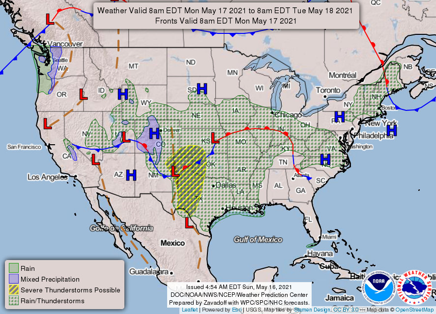
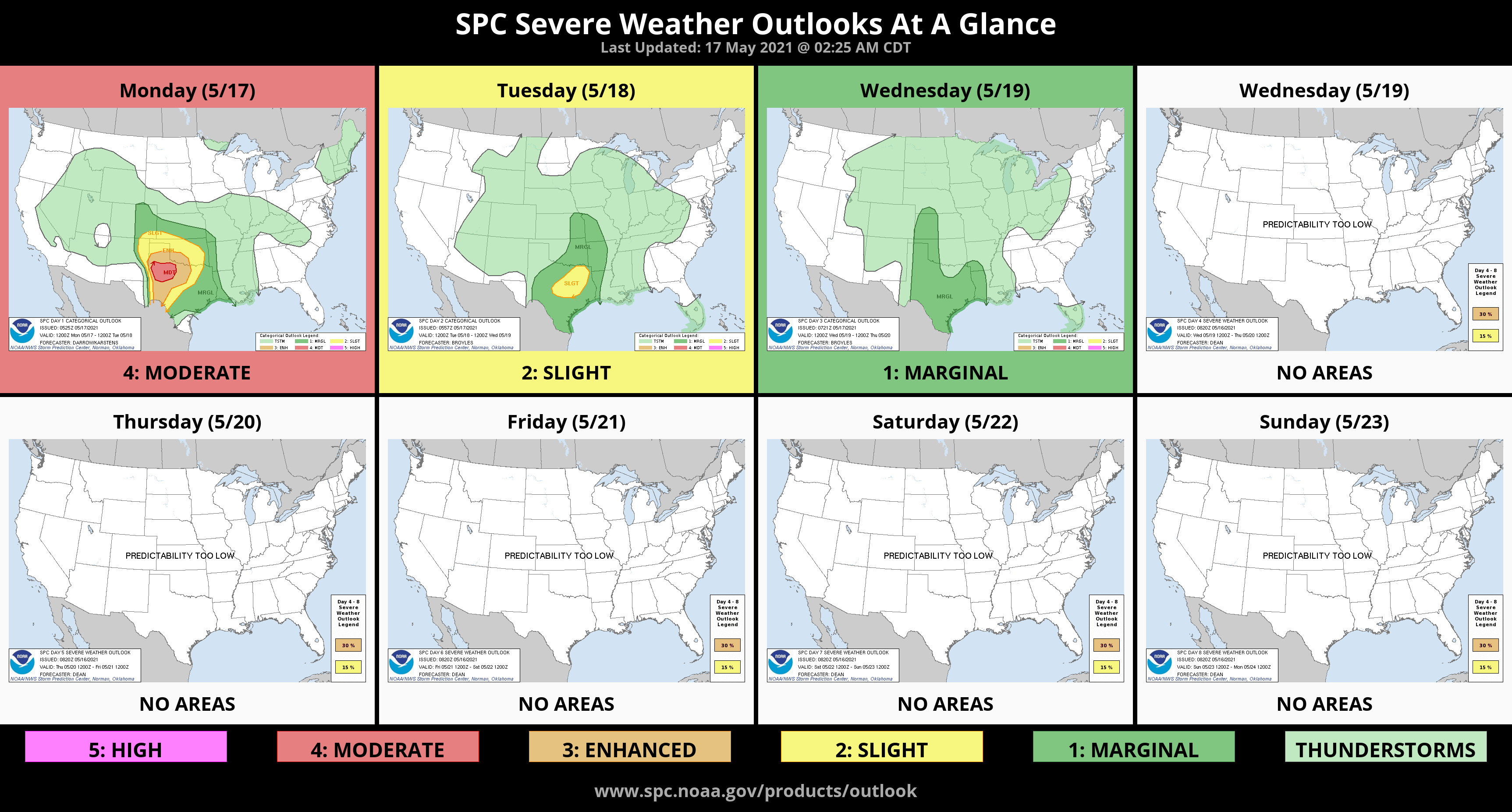
1- SLIGHT RISK for severe weather later this evening. This said, we have been fairly lucky so far as to not have any severe weather. The way the pattern looks, which by the way is very sporadic, we could stay in that middle area where storms will go south of us but we may see some shower activity as storms move across Kansas.
2- As you go south, there is an Enhanced Risk area and then a Moderate Risk area. Be extremely careful later today if you have to travel that way. The forecast will vary some so keep that in mind. We’ll update as needed but just know that thunderstorms are possible each day this week through next weekend. If you have outdoor activities planned due to graduations etc., we really won’t know what may happen until the morning of that event and then it will change some.
3- Here is your forecast from the NWS/NORMAN;
Today-Mostly cloudy. A chance of thunderstorms in the morning, then a slight chance of thunderstorms in the afternoon. Highs in the upper 70s. Light and variable winds becoming east around 10 mph in the afternoon. Chance of thunderstorms 40 percent.
Tonight-A chance of thunderstorms in the evening, then thunderstorms after midnight. Lows in the lower 60s. East winds around 10 mph. Chance of thunderstorms 80 percent.
No updated graphics from the NWS in Norman again at 4am. Today’s graphics are from the WPC AND SPC.
Have a good day!
MIKE