0310L-TUESDAY OUTLOOK FROM GARFIELD COUNTY EMERGENCY MANAGEMENT-5/18/21
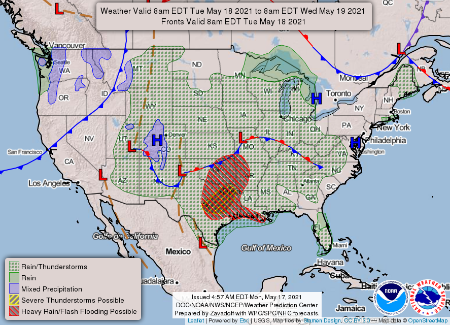
1- GENERAL THUNDERSTORM RISK today and later tonight. At 0245 local time this morning, thunderstorms are ongoing just to our west and southwest and it appears we may see some rainfall around the area. We may see some ½ inch hail and some wind gusts upwards of 45-50 mph early this morning so be prepared for that. The tropical atmosphere will present heavy rainfall amounts as cells move over the area and these cells aren’t moving very fast. Training of cells could also cause some localized flooding, so use extreme caution while driving.
2- Overall, we’ll be ok and we’ll continue to monitor our weather situation. Here is your countywide forecast from the NWS/NORMAN;
Tuesday-Cloudy. A chance of thunderstorms in the morning, then thunderstorms likely in the afternoon. Highs in the mid-70s. Southeast winds around 10 mph. Chance of thunderstorms 70 percent.
Tuesday Night-Showers and a slight chance of thunderstorms in the evening, then showers likely and a slight chance of thunderstorms after midnight. Lows around 60. Southeast winds around 10 mph.
FINALLY- Be sure to download our GARFIELD COUNTY EM app. It’s a great preparedness tool and it just could save your life!
HAVE A GOOD DAY!
MIKE