0405L-SUNDAY OUTLOOK FROM GARFIELD COUNTY EMERGENCY MANAGEMENT-5/16/21
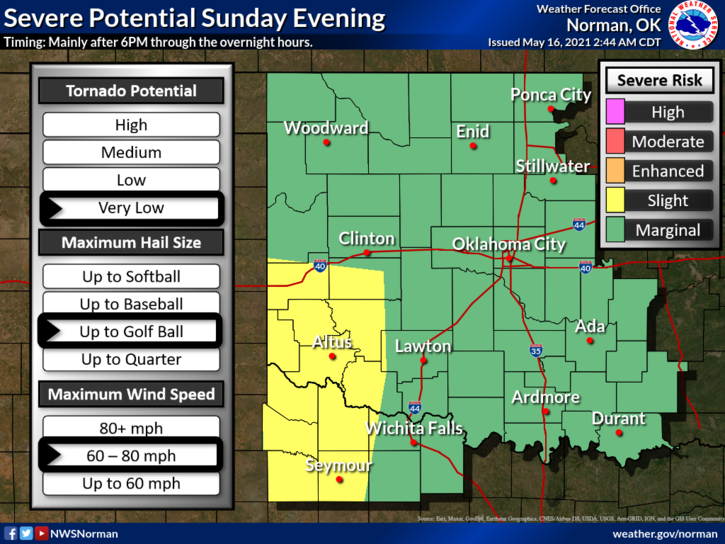
1- We are in a MARGINAL RISK area again for possibly severe weather later today. IF STORMS OCCUR, see graphic 1 for the possible risks. Over the last several days, most storms have developed out west and have moved to our north and a few south. Will tonight be any different? I will water my yard and maybe the truck today and we’ll see what happens. 😊
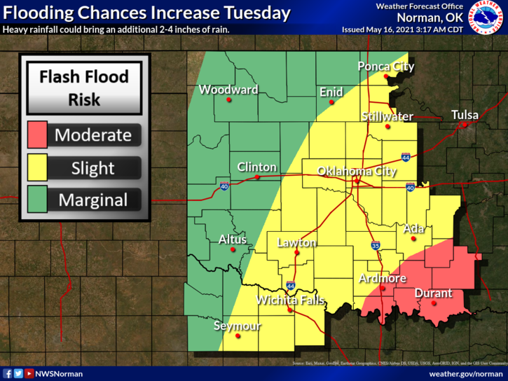
2- If we do see any rainfall, storms will move slowly and depending on the strength of the storms and training, we could see several inches of rain in some areas so if it actually does rain, keep this in mind as flooding will become a concern. That said, there is a Flood Watch in effect from Greer County to Payne County and areas south through Wednesday so if you plan to travel, just stay weather aware. There is a CHANCE for storms every day this coming week.
3- Be sure to have our GARFIELD COUNTY EM app on your phone so you will be advised if anything goes awry. Here is your forecast from the NWS/NORMAN;
Today-A chance of thunderstorms in the morning, then thunderstorms in the afternoon. Highs in the mid-70s. South winds 10 to 15 mph. Chance of thunderstorms 80 percent.
Tonight-Mostly cloudy. A slight chance of thunderstorms in the evening, then thunderstorms likely after midnight. Lows in the lower 60s. Southeast winds 10 to 15 mph in the evening becoming light and variable. Chance of thunderstorms 70 percent.
HAVE A GOOD DAY!
MIKE