0350L-MONDAY OUTLOOK FROM GARFIELD COUNTY EMERGENCY MANAGEMENT-5/20/19
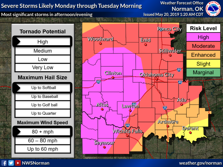
1-We are in a MODERATE RISK for severe weather and not too far from the HIGH RISK area. ALL HAZARDS ARE POSSIBLE TODAY-see graphics attached for hazards, timing, etc. These will change some during the day so just make sure you are prepared as best you can.
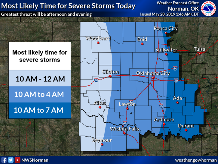
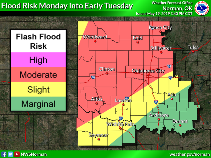
2- Our spotter network has been placed on standby and will be deployed with ANY severe storms that approach the area. One of our larger threats today will be flooding as we do expect torrential rainfall. Winds will be another factor so secure anything outside that could take flight. The atmosphere is very unstable and large hail will be a large factor too.
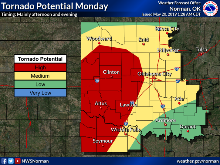
3- As for the tornado threat, it does exist so make sure your plans include being near your safe areas. We don’t have public shelters in Enid. If you decide to go to a church or a stronger building, call them first and make arrangements. Don’t wait until the sirens go off because if they do, you could be in imminent danger at that time. Be sure and listen for emergency information from our local radio stations as we coordinate with them too.
4- On social media- we will do live broadcasts on our emergency management page only. I don’t have enough staff to cover both pages. Here is the link on Facebook- @EGCEM yes, all caps. Severe warnings will come through our GARFIELD COUNTY EM app automatically and we’ll post as needed. HOPEFULLY THE INTERNET HOLDS UP. This is always a fear!!
5- The main issue now is you remaining calm, even though you might be scared. Until storms actually start to affect us, we have time to adjust our plans and procedures. Do the best you can to stay calm, think clearly, and make good decisions based on reliable information.
6- Here is your forecast for today from the NWS/NORMAN;
Monday-Showers and thunderstorms, mainly after 7am. Some of the storms could be severe and produce heavy rainfall. High near 67. East wind 13 to 20 mph, with gusts as high as 28 mph. Chance of precipitation is 90%. New rainfall amounts between 2 and 3 inches possible.
Monday Night-Showers and thunderstorms. Some storms could be severe, with damaging winds and heavy rain. Low around 63. East southeast wind 16 to 20 mph, with gusts as high as 28 mph. Chance of precipitation is 90%. New rainfall amounts between 2 and 3 inches possible.
Stay alert and we’ll advise as needed.
MIKE