0325L-TUESDAY OUTLOOK FROM GARFIELD COUNTY EMERGENCY MANAGEMENT-5/21/19
Words for today- WET & SOGGY. Need to add TIRED to this too. Please send me your rainfall totals preferably to mike@gcem.org
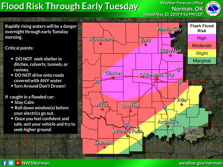
1- We are under FLOOD WARNING until 9 am this morning. We do expect a few more thunderstorms but rainfall amounts should be less than an inch or so. We’ve had anywhere from 3 to 4.5 inches of rainfall depending where you are and from some of the reports I have received, so be extremely careful when venturing out this morning. We have many areas around the county where water is over the roads. I don’t have a complete list but if ANY route you normally drive goes through a low lying area, SLOW DOWN, and watch for water over the roads, especially if it’s still dark outside. DIRT ROADS are mud now. Don’t drive down any of them. If you can’t get through, we probably can’t either. Barricades have been placed in numerous areas all around the county so please don’t drive around them. Cars and trucks are not boats; they don’t do well in high water.
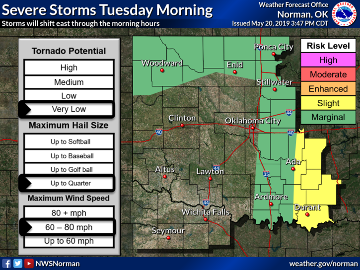
2- I want to thank our SPOTTERS for their quick response yesterday during tornadic storms in the southern part of the county. Between our Rural Fire network of spotters, Garfield County deputy’s, and Enid Police, we had the county covered. Several rescues were conducted during this timeframe and all folks I believe are ok, just a bit shook up. We will be assessing the whole county as soon as conditions warrant.
3- Here is your forecast from the NWS/NORMAN;
Tuesday-40 percent chance of showers and thunderstorms before 1pm. Cloudy through mid- morning, then gradual clearing, with a high near 74. South southwest wind 10 to 15 mph increasing to 15 to 20 mph in the afternoon. Winds could gust as high as 30 mph.
Tuesday Night-Mostly clear with a low around 57. South wind 10 to 15 mph, with gusts as high as 25 mph.
HAVE A GOOD DAY!!
MIKE