0350L-MONDAY OUTLOOK & INFO FROM GARFIELD COUNTY EMERGENCY MGMT-5/25/2020
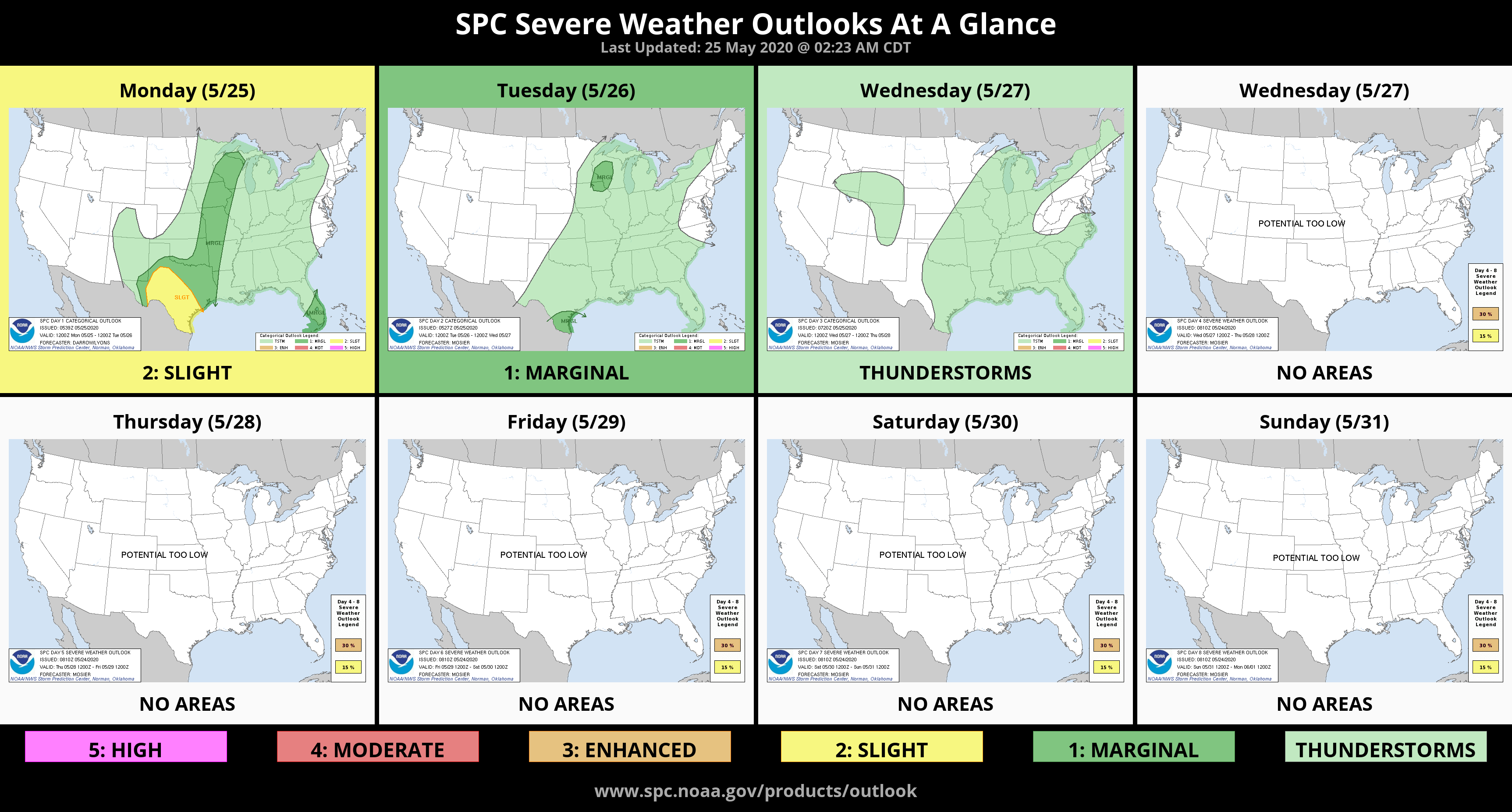
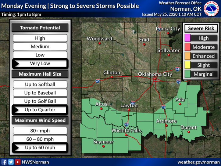
1- We are in a GENERAL THUNDERSTORM RISK area. This means our chances are low but not out of the question. Severe weather is not expected here but will be prevalent along the southern border counties of Oklahoma. A frontal boundary is expected sometime late this morning or early afternoon.
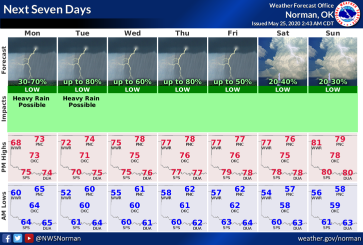
2- If showers and a few storms occur, heavy rainfall will be the main issues. Overall, we’ll be ok. This week will be cooler than normal so enjoy this while you can. Yesterday was a mild precursor to warm and humid weather. We will be warming up after this week. Here is your forecast from the NWS/NORMAN;
Today- Cloudy and cooler with a 70% chance of thunderstorms today. Highs in the lower 70s with southeast winds around 10 mph shifting to the northwest in the afternoon.
Tonight- Cloudy with a 50% chance of thunderstorms. Lows in the upper 50s with Northwest winds 10 to 15 mph.
STAY SAFE AND HAVE A GREAT DAY!
MIKE