0350L-SUNDAY OUTLOOK & INFO FROM GARFIELD COUNTY EMERGENCY MGMT-5/24/2020
1- We had what is called a WAKE LOW develop behind that initial line of t-storms. Winds upwards of 62 mph were felt all around the county and the region. At 0315am, winds have settled down some but the NWS had already issued a high wind warning UNTIL 0600. Probably the basic definition is wake lows are small areas of low pressure that form on the back side of an area of rain or a squall line or in its wake. A quick change in air pressure is what causes the winds. This can happen without warning and winds can be felt from storms quite a ways away.
2- I know everyone is still a little jumpy from the other day but it is storm season so just understand that these can happen at any time when atmospheric pressure changes abruptly. Heat Bursts can happen too. You can search these terms and read about them on your own.
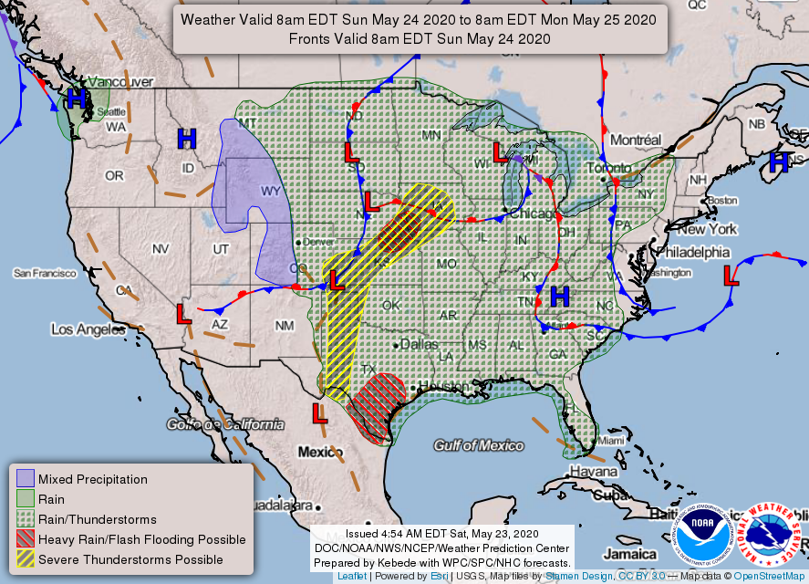
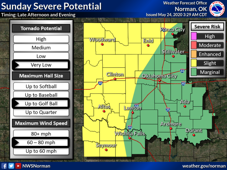
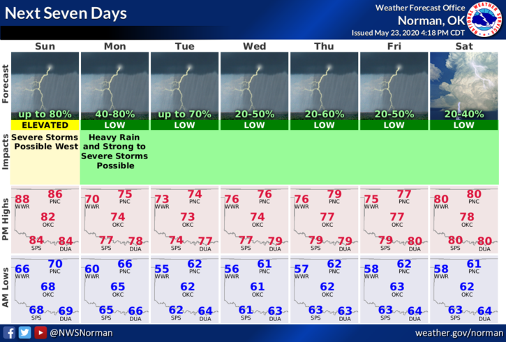
3- For today, we may see some shower activity during the day but storms will fire up once again out west along the dryline and eventually move through the area later tonight. We are in a SLIGHT RISK AREA for severe weather so we’ll deal with that too. Here is your forecast from the NWS/NORMAN;
Today-Decreasing clouds. A slight chance of thunderstorms until late afternoon, then a chance of thunderstorms late in the afternoon. Highs in the upper 80s. South winds 15 to 20 mph. Chance of thunderstorms 30 percent.
Tonight-Mostly cloudy. A chance of thunderstorms in the evening, then thunderstorms likely after midnight. Lows in the lower 60s. Southeast winds 10 to 15 mph. Chance of thunderstorms 70 percent.
HAVE A GOOD DAY AND WE’LL ADVISE AS NEEDED.
MIKE