0350L-MONDAY OUTLOOK FROM GARFIELD COUNTY EMERGENCY MANAGEMENT-11/23/2020
GARFIELD COUNTY EM is our notification app. If you don’t have it, you will need it. Just remember-PREPAREDNESS=RESILIENCE
1- Just an FYI to everyone. I no longer have facebook on my phone. They continue to change settings that I can’t reverse. I like to think that I am in control of my phone and now I am. I would be logged out and suddenly all by itself, I was logged in. As always, I don’t live on social media so if you need to contact me, call, email, or text me.
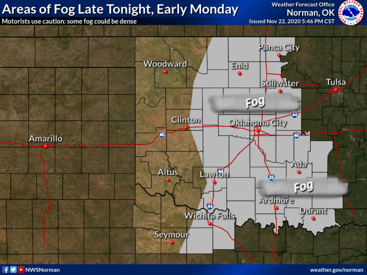
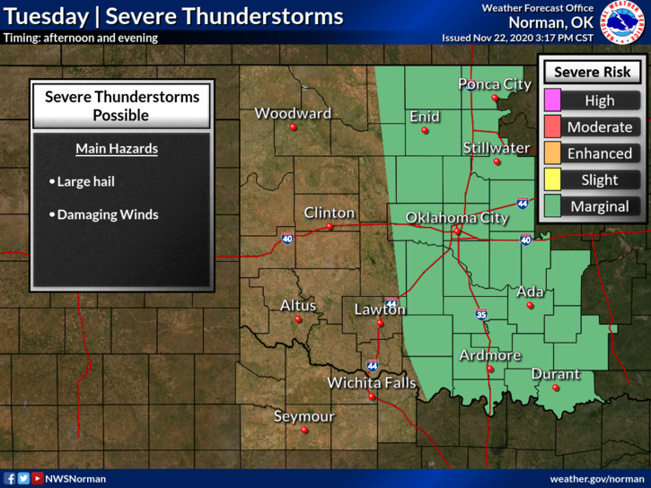
2- Weather-wise, FOG may be around this morning so be careful while driving especially in low-lying areas. The winds will be increasing and be a little gusty so keep that in mind when driving. Rain enters the forecast late tonight through Tuesday night with a Marginal Risk for severe weather Tuesday evening. If storms occur here, hail and wind would be the main threats. We’ll see how this comes together.
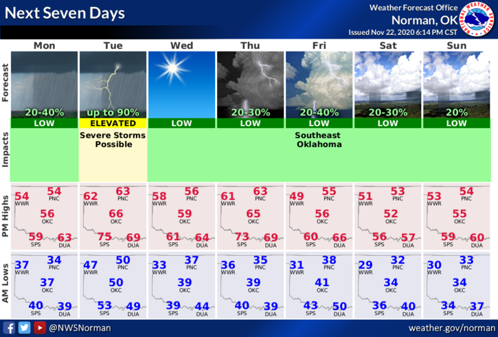
3- Here is your forecast from the NWS/NORMAN;
Today- Mostly cloudy. Highs in the mid-50s. South winds 10 to 15 mph with higher gusts.
Tonight- Mostly cloudy. A chance of rain showers after midnight. Not as cool. Lows in the upper 40s. South winds 15 to 20 mph with higher gusts. Chance of showers 40 percent.
HAVE A GOOD DAY!
MIKE