0330L-TUESDAY OUTLOOK FROM GARFIELD COUNTY EMERGENCY MANAGEMENT-11/24/2020
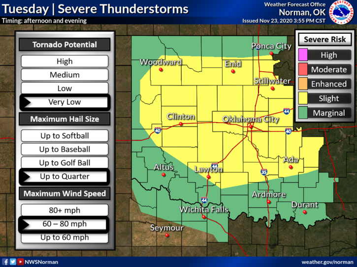
1- We are in a SLIGHT RISK AREA for severe weather this afternoon into this evening. Main threats are quarter size hail, winds to 80 mph, and a very low threat for isolated tornadoes. All this is dependent on where this storm system out west actually tracks and where the front is when this mess arrives. SEE GRAPHIC BELOW.
2- This would be one of times where having our GARFIELD COUNTY EM app would definitely be a good idea. NWS warnings and info from us automatically comes through our app so you stay up to date with information. PREPAREDNESS=RESILIENCE
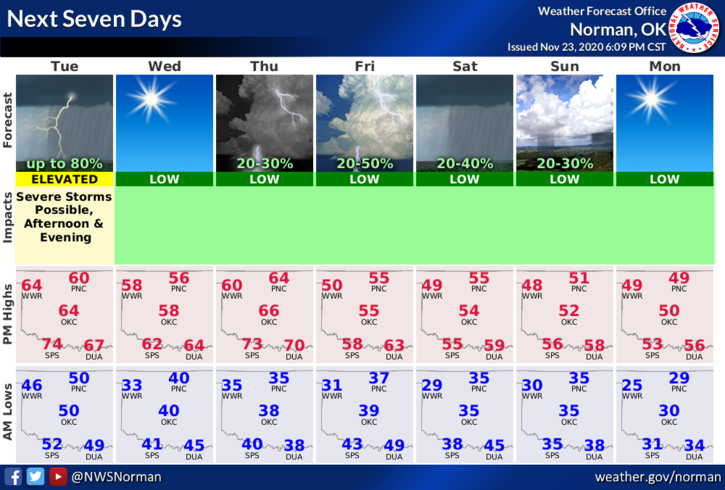
3- OVERALL, we’ll be ok but stay weather aware. Here is your forecast from the NWS/NORMAN;
Tuesday-Showers possible this morning then an 80% chance for thunderstorms this afternoon. Some of the storms could be severe. High near 62. South southeast wind 15 to 25 mph gusting to 32 mph are possible.
Tuesday Night-40 percent chance of showers and thunderstorms before midnight. Some of the storms could be severe. Low around 38. South wind 15 to 20 mph becoming northwest after midnight. Winds could gust as high as 25 mph.
HAVE A GOOD DAY!!
MIKE