0335L-MONDAY OUTLOOK FROM GARFIELD COUNTY EMERGENCY MANAGEMENT-10/11/21
1- We received 1 inch of rainfall overnight. It probably was more but I haven’t figured out how to catch horizontal rainfall and be accurate at that. We did have strong winds which according to the Mesonet, maximum wind gusts were at 37 mph.
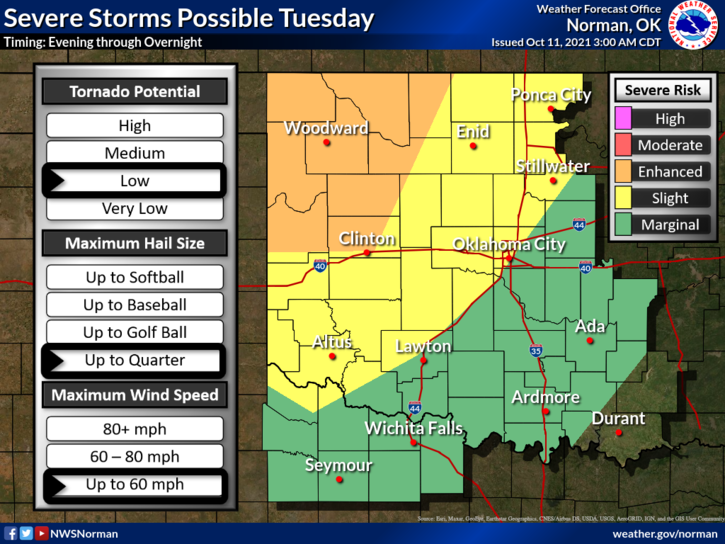
2-The heavier and severe weather stayed mostly south and east as stated early yesterday but we will have another opportunity for additional severe weather on Tuesday. I received many texts and several calls concerning what to do and where to go during severe weather. If you have our GARFIELD COUNTY EM app, tap the center icon that says Director’s Tips and read that document. I will set up a permanent link to that document on the gcem.org website today and post that link tomorrow morning.
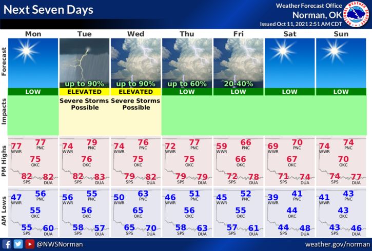
3- Overall, we did ok for this event and we receive much needed rainfall and we’ll have cooler temps to deal with this week. Remember that we may face a higher severe threat on Tuesday depending how that system tracks. More on this later. Here is your forecast from the NWS/NORMAN;
Today-Sunny. Highs in the upper 70s. West winds 10 to 15 mph.
Tonight-Mostly clear. Lows in the lower 50s. Southeast winds around 10 mph.
STAY SAFE
MIKE