0400L-TUESDAY OUTLOOK FROM GARFIELD COUNTY EMERGENCY MANAGEMENT-10/12/21
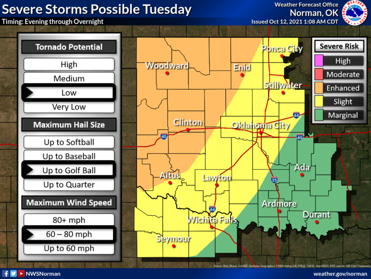
1- We are in an ENHANCED/SLIGHT risk area for severe weather later today into the overnight hours. The forecast discussion this morning didn’t go into the detail I personally like to see but we do have a briefing later this morning from the NWS and we’ll get updated information from that. I will send a new outlook based on NWS GUIDANCE between 1300-1400 local time, (1 to 2 pm).
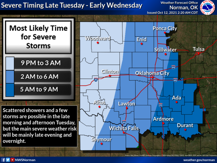
2- The above said, it appears we are looking at an overnight event. For now, NO NEED TO PANIC. The briefing will give us more information that we’ll pass along. Here is your forecast from the NWS/NORMAN;
Today-Increasing clouds. A slight chance of thunderstorms later this morning through the late afternoon hours. Highs in the mid-70s. Southeast winds 10 to 20 mph. Chance of thunderstorms 70 percent.
Tonight-A chance of thunderstorms in the evening, then thunderstorms after midnight. Lows in the upper 50s. South winds 15 to 20 mph.
FINALLY, I would advise you, if you don’t have our GARFIELD COUNTY EM app, to get it downloaded. It just might be what you may need overnight.
HAVE A GOOD DAY AND STAY SAFE!
MIKE