0330L-MONDAY OUTLOOK FROM GARFIELD COUNTY EMERGENCY MANAGEMENT-9/11/23
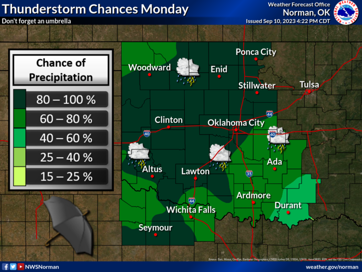
GENERAL RISK for storms today. We’ll see what develops.
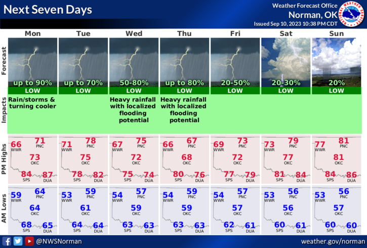
*Cooler weather will be around for at least the next 5-7 days. High temps will average around 70 give or take. Thunderstorms will be isolated but we could see rain totals around ¼ to ½ inch IF we see heavier rainfall. If any severe weather were to occur, wind and hail would be the two main threats. We’ll see how all this mess tracks.
*Overall, we’ll be ok and cooler so enjoy. Here is your forecast from the NWS/NORMAN;
Today- Showers. Isolated thunderstorms this morning, then a chance of thunderstorms this afternoon. Much cooler with highs in the upper 60s. North winds 5 to 10 mph, becoming northeast this afternoon. Chance of rain near 100 percent.
Tonight- Mostly cloudy. Showers likely with a chance of thunderstorms in the evening, then a slight chance of showers and thunderstorms after midnight. Lows in the upper 50s. North winds 5 to 10 mph. Chance of rain 70 percent.
HAVE A GOOD DAY!