0320L-MONDAY OUTLOOK FROM GARFIELD COUNTY EMERGENCY MANAGEMENT-9/27/21
1- The Fire Danger will be mitigated some due to higher dewpoint temps in the 50s and humidity will be in the 20s today instead of the teens. We are still very dry so use extreme caution doing anything related to fire. We keep a close eye on guidance from the NWS but also from State Forestry. Forestry gives us guidance on surface fuels, spread component data, and much more which are important to the fire service.
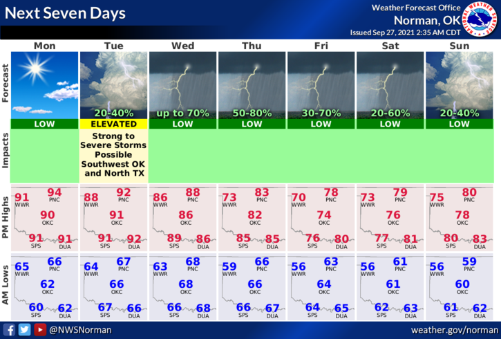
2- LETS TALK RAIN! We do have a good chance for rain this week. For us, it appears mid-week and beyond to have the better chance for precipitation. Another cold front around mid-week, possibly Thursday, will push in bringing us that chance along with cooler air. We’ll see what happens for sure. Either way, rain chances will be around starting later on Tuesday.
Overall, we’ll be ok so here is your forecast from the NWS/NORMAN;
Today-Mostly sunny. Highs in the mid-90s. South winds 10 to 20 gusting to 25 mph.
Tonight-Partly cloudy. Lows in the mid-60s. South winds 10 to 15 mph.
STAY SAFE
MIKE