0405L-MONDAY-LABOR DAY OUTLOOK FROM GARFIELD COUNTY EMERGENCY MANAGEMENT-9/7/20
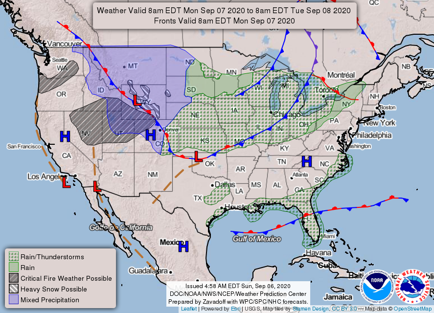
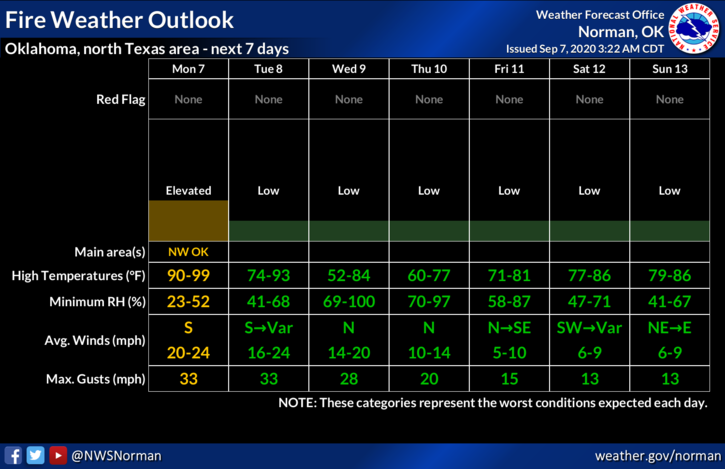
1-HOT, DRY, & WINDY with a cold change in our near future. Rain will be a possibility depending on where other troughs end up. It’s still complicated! Our FIRE DANGER will increase especially today and if by chance rainfall doesn’t occur, it will remain fairly high all week. As for the cold front, it appears it will be in here Tuesday early afternoon per guidance. This may change so just be prepared dropping temps after frontal passage.
2- With the passing of the front, we’ll see winds shift from southerly to northerly gusting upwards of 25 mph or more. As for today, winds will be up there again so be prepared for stronger winds than yesterday.
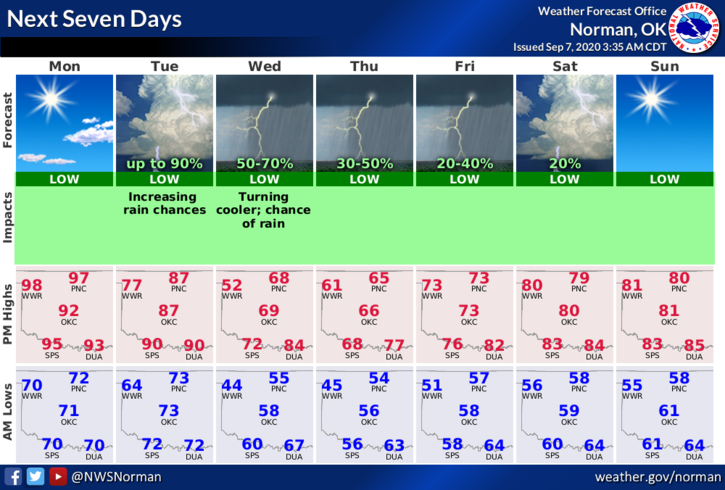
3-Overall, we’ll be ok so keep your eyes peeled for smoke and or fire and report it to 911 ASAP. Here is your forecast from the NWS/NORMAN;
Today-Sunny with a high near 96. South southwest wind 15 to 25 mph with gusts as high as 32 mph.
Tonight-Mostly clear, with a low around 67. South wind around 16 mph, with gusts as high as 23 mph.
HAVE A GOOD DAY!!
MIKE