0400L-TUESDAY OUTLOOK FROM GARFIELD COUNTY EMERGENCY MANAGEMENT-9/8/2020
DOWNLOAD our GARFIELD COUNTY EM app. You’re NOT PREPARED without it.
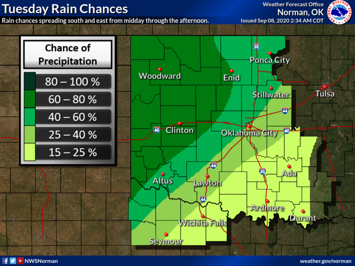
1- THE COLD FRONT IS SLOWLY MOVING OUR WAY. It should be in the area this afternoon. Timing is roughly between 2 & 5 pm but don’t hold your breath on this either. Timing has been an issue as this front moves at its own pace. Rain is also possible so as it approaches and moves through the area, we’ll see how all of this comes together.
2- When the front arrives, winds will become strong out of the north upwards of 25-30 mph so be ready for that change too. Overall, we’ll be ok but colder temps are on the way.
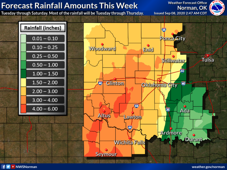
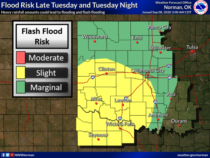
3- Rainfall is possible later today, overnight, and into Wednesday. Rainfall totals for us should be around 1-2 inches overall if rainfall occurs at all.
4- Yesterday, we had very weird looking skies as smoke from wildfires in California, Utah, and Colorado were transported over our area. This did affect our temps a little but it was a good showing of how major incidents quite a ways away can affect areas around the country.
5- Here is you forecast from the NWS/NORMAN;
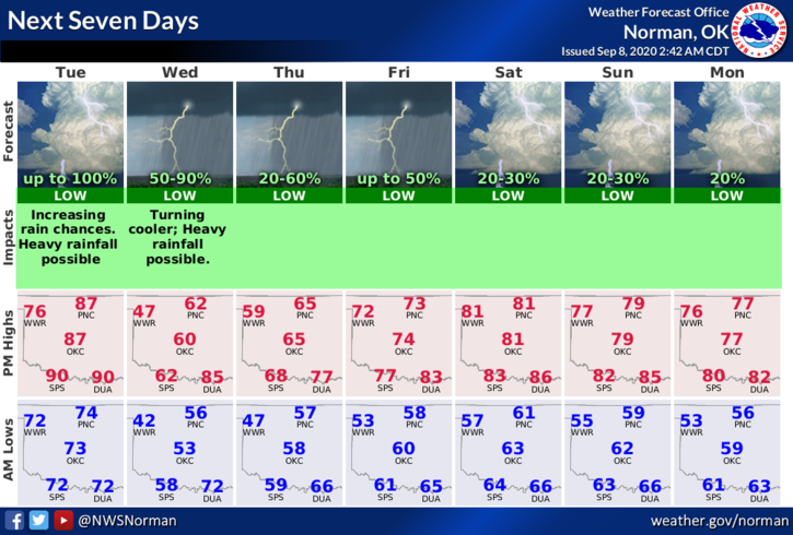
Today-Mostly sunny in the morning, then a 60 percent chance of thunderstorms this afternoon and overnight. Highs in the upper 80s. South winds 10 to 20 mph with gusts around 30 mph.
Tonight-Rain and a chance of thunderstorms in the evening and overnight. Much cooler with lows around 50. North winds 15 to 20 mph with higher gusts.
HAVE A GOOD DAY!!
MIKE