0310L-WEDNESDAY OUTLOOK FROM GARFIELD COUNTY EMERGENCY MANAGEMENT-10/27/21
1- The world didn’t come to an end overnight but we did receive another ½ inch of rainfall. Let me know your totals if you have time. The system that caused our rainfall was very severe out west and southwest last evening and then remained somewhat severe as it moved east/northeast. The leading edge of this system is now in the eastern part of the state.
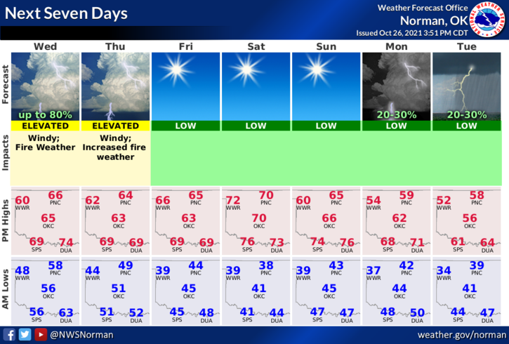
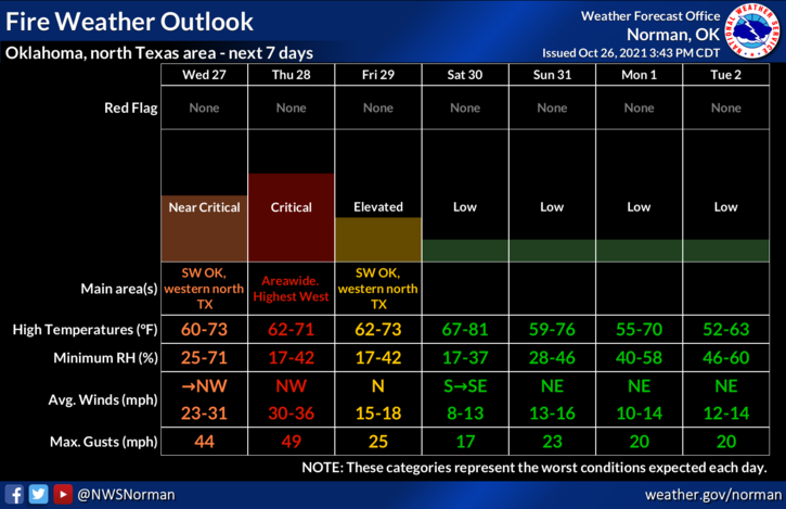
2- Winds will become our next nemesis for a few days so keep everything secure around the house and keep an eye out for smoke and fire since the FIRE DANGER will be very prevalent today thru Friday. Some wind gusts upwards of 50 mph will be possible. This weekend looks really good so if you can get outside, soak in that good natural vitamin D. Here is your forecast from the NWS/NORMAN;
Wednesday-30 percent chance of showers and thunderstorms, mainly before 11am. Mostly cloudy, with a steady temperature around 59. West wind 15 to 25 mph becoming north northwest with frontal passage. Winds could gust as high as 34 mph.
Wednesday Night-30 percent chance of showers before 1am. Mostly cloudy, with a low around 48. Windy, with a north northwest wind 20 to 30 mph, with gusts as high as 49 mph.
STAY SAFE AND HAVE A GOOD DAY!
MIKE