0330L-TUESDAY OUTLOOK FROM GARFIELD COUNTY EMERGENCY MANAGEMENT-10/26/21
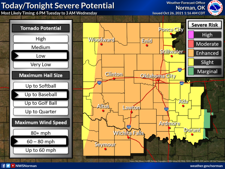
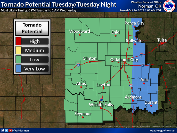
- We are in an ENHANCED RISK for severe weather later this evening through the overnight hours. All weather hazards are possible but winds and hail look to be our biggest threats as it appears right now. Everything will depend on where storm initiation actually occurs. Either way, we’ll see how this mess develops and deal with it accordingly. I will do a live broadcast later today as development occurs too.
2- Per the above information, I would secure anything that could take flight in your yards and make sure you are prepared for possibly some severe storms. We’ll see what happens.
3- Here is your forecast from the NWS/NORMAN;
Today-Partly cloudy. Warmer. Highs in the upper 70s. Southeast winds 10 to 20 mph shifting to the south 20 to 25 mph with higher gusts in the afternoon.
Tonight-Thunderstorms in the evening, then a chance of thunderstorms after midnight. Some thunderstorms may be severe in the evening. Lows in the lower 50s. Southeast winds 15 to 25 mph with higher gusts. Chance of thunderstorms 80 percent.
We’ll advise as needed.
Mike