FROM GARFIELD COUNTY EMERGENCY MANAGEMENT
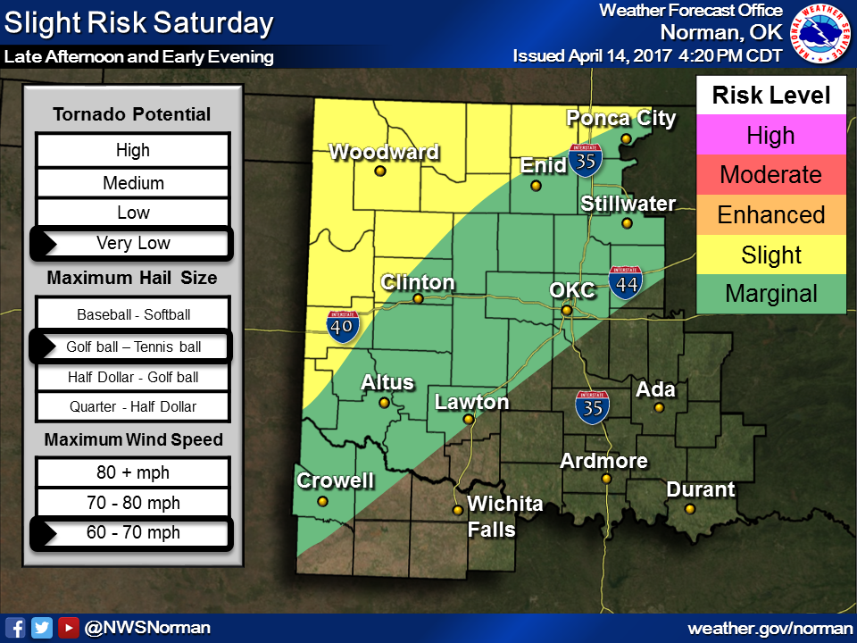
We are in a SLIGHT RISK area for severe weather later today and tonight. DON’T PANIC!! This is a normal springtime weather event. Happens every year at various times. As it appears, we may see this occur many times over the next few months or so. IF STORMS DO OCCUR, large hail and damaging winds are the main threats. Don’t change your plans but just stay weather aware and you’ll be ok.
Be sure to download our GARFIELD COUNTY EM APP so you can keep up with information from your trusted local source along with the NWS. ALSO, all warnings from the NWS come through our app automatically. You can turn this feature off but I wouldn’t recommend that.
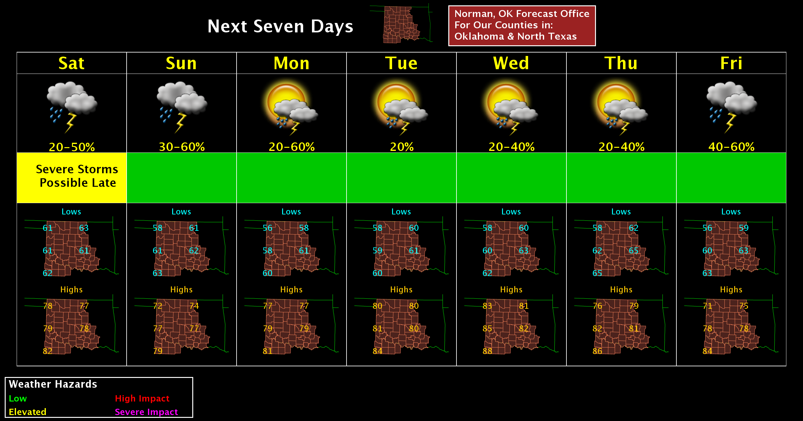
FYI- I don’t stay on facebook or twitter on a full time basis. If anyone has questions, message me on messenger and/or text me and I will get back to you as soon as I can. Here is your forecast from the NWS/NORMAN;
Saturday… partly cloudy. highs in the mid 70s. south winds 15 to 25 mph gusting to 35 mph or so..
Saturday night… mostly cloudy. a chance of thunderstorms in the evening, then thunderstorms likely after midnight. lows in the upper 50s. south winds 10 to 20 mph. chance of thunderstorms 60 percent.
Have a great day!!
MIKE