FROM GARFIELD COUNTY EMERGENCY MANAGEMENT
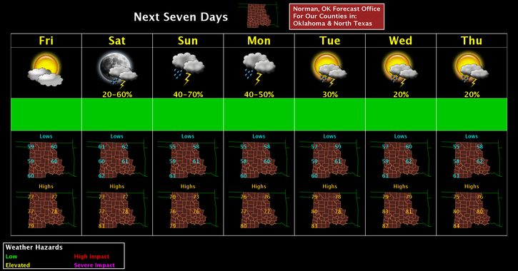
We received around ¼ to ½ inch of much needed rainfall in the area yesterday. I haven’t received any reports of higher amounts as of yet. As it looks right now, we look to receive more rain over the weekend and next week. Some details are a little sketchy right now for next week but as details become available, keep up with the latest from the NWS and us, of course.
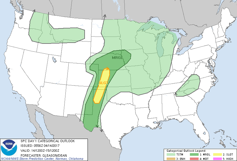
There is a slight risk for severe weather later today out west. IF you plan on traveling through the panhandle region later today, pay very close attention to what’s going on around you. If storms occur out there, large hail, damaging winds, and MAYBE an isolated tornado could occur. Just be careful and pay attention.
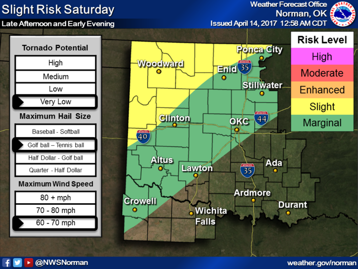
On Saturday here in our area, we will have a good chance for heavy weather so don’t change your plans yet but again as stated above, pay attention to the latest from the NWS. We will post any major change in the forecast if it relates to severe weather for late tonight and tomorrow.
Be sure and download our GARFIELD COUNTY EM app so you will be up to date with the latest local information from our office.
Here is your forecast from the NWS/NORMAN;
Friday-A slight chance of showers and thunderstorms between 7am and 10am. Cloudy, then gradually becoming mostly sunny, with a high near 75. South wind 13 to 20 mph, with gusts as high as 28 mph. Chance of precipitation is 20%.
Friday Night-Partly cloudy, with a low around 61. South wind 16 to 18 mph, with gusts as high as 25 mph.
HAVE A SUPER DAY!!
MIKE