0330L-SATURDAY OUTLOOK FROM GARFIELD COUNTY EMERGENCY MANAGEMENT 04/27/24
GARFIELD COUNTY EM is our notification app. You WILL need it today. NWS warnings automatically come through along with info from us.
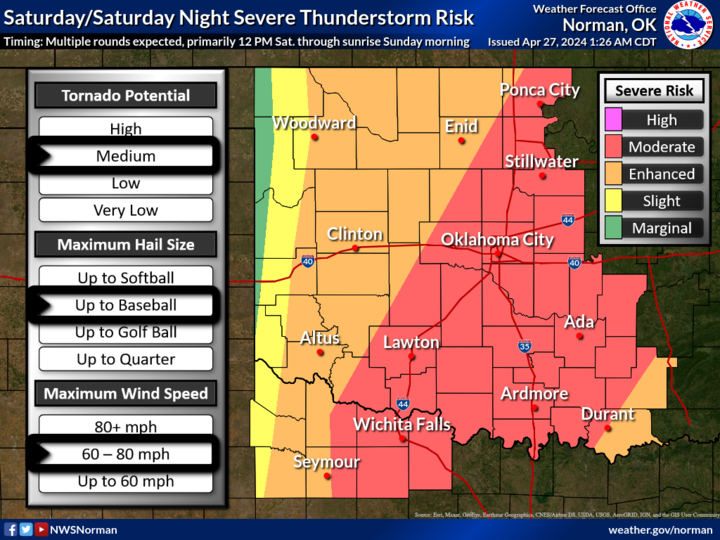
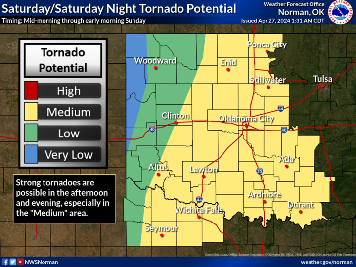
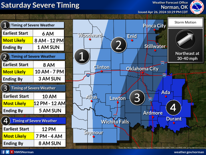
*We are in an ENHANCED and MODERATE RISK area for severe weather later today. The Storm Prediction Center is expecting a TORNADO OUTBREAK from NORTH TEXAS thru SE KANSAS into SW MISSOURI. This stated, no need to panic but the tv media will be going crazy with this so take long deep breaths, stay calm, and we’ll see where storms fire up and move. We do expect multiple rounds starting earlier this morning so where storms fire this morning, expect wind and hail. This afternoon, expect all hazards, especially southeast and east of us.
*At 0315L, the dryline is way out west with Fire Danger west of it, see graphic 4. The main storm system is moving our way and the low level jet, which will be a factor in ramping up the storms will arrive this morning. Here is a link to the SPC discussion- https://www.spc.noaa.gov/products/outlook/day1otlk.html If you decide to read it, go slowly as this will change a little throughout the day as mesoscale discussions occur. Here is the discussion from the NWS/NORMAN- https://forecast.weather.gov/product.php?site=NWS&issuedby=OUN&product=AFD&format=CI&version=1&glossary=1 This information will change some during the day too.
*As stated in previous posts, just have your plan in mind or written, be prepared to implement it, and we’ll see what happens. Our SPOTTERS are Rural Fire, Sheriff Deputies, and Enid Police. They have all been notified of the threats today so if they are needed, they will be activated.
*OVERALL, we’ll be ok so just be prepared and I will update a few times on social media at this address on facebook- @EGCEM. Also, you can register your storm shelters with us on our website at this link- https://gcem.org/storm-shelter-registration/
*Here is your forecast from the NWS/NORMAN;
Today- Mostly cloudy. A chance of showers and thunderstorms this morning, then showers with thunderstorms likely this afternoon. Some thunderstorms may be severe. Breezy with highs in the upper 70s. South winds 20 to 25 mph with gusts up to 35 mph. Chance of rain 90 percent.
Tonight- A chance of thunderstorms. Showers likely. Some thunderstorms may be severe. Lows in the upper 50s. South winds 15 to 20 mph. Gusts up to 35 mph in the evening. Chance of rain 70 percent.
HANG IN THERE AND HAVE A GOOD DAY!