0335L-SATURDAY OUTLOOK FROM GARFIELD COUNTY EMERGENCY MANAGEMENT 04/06/24
*Download our GARFIELD COUNTY EM app. You’ll receive info from us and the NWS in detail.
* WORST FEARS answers will begin SUNDAY morning instead of this morning.
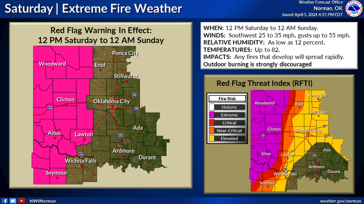
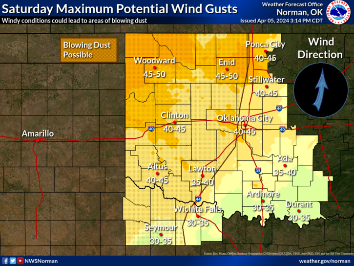
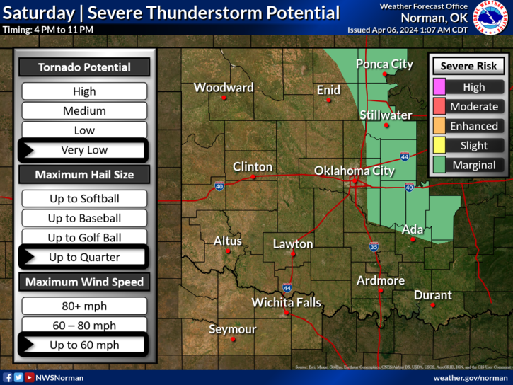
*We are in a WIND ADVISORY from 7am until 10pm tonight for winds 25-35 gusting to 55mph and next door to a RED FLAG WARNING from noon today until midnight tonight. Lines on the graphics will fluctuate so don’t get too fixated on those locations. Northeastern Garfield County is also in a MARGINAL RISK area for severe weather later today depending on where the dryline ends up.
*Basically, it’s going to be very windy, dirty, and maybe smokey if any fires get going. I will state that NO CONTROLLED BURNING IS ADVISED. With the winds forecasted, any fire will get out of control very quickly. Call 911 if you see smoke or fire. Overall, we should be ok so here is your forecast from the NWS/NORMAN;
Today- Sunny. A slight chance of showers and thunderstorms this afternoon. Patchy blowing dust this afternoon. Very windy with highs in the upper 70s. Southeast winds 20 to 30 mph, becoming south 30 to 35 mph this afternoon. Gusts up to 50 mph. Chance of rain 20 percent.
Tonight- Mostly clear and breezy. Lows in the upper 40s. Southwest winds 15 to 25 mph. Gusts up to 40 mph in the evening.
Have a good day!