0310L-SATURDAY OUTLOOK FROM GARFIELD COUNTY EMERGENCY MANAGEMENT-8/12/23
*HEAT ADVISORY, ONCE AGAIN, FROM 12 NOON UNTIL 9PM THIS EVENING.
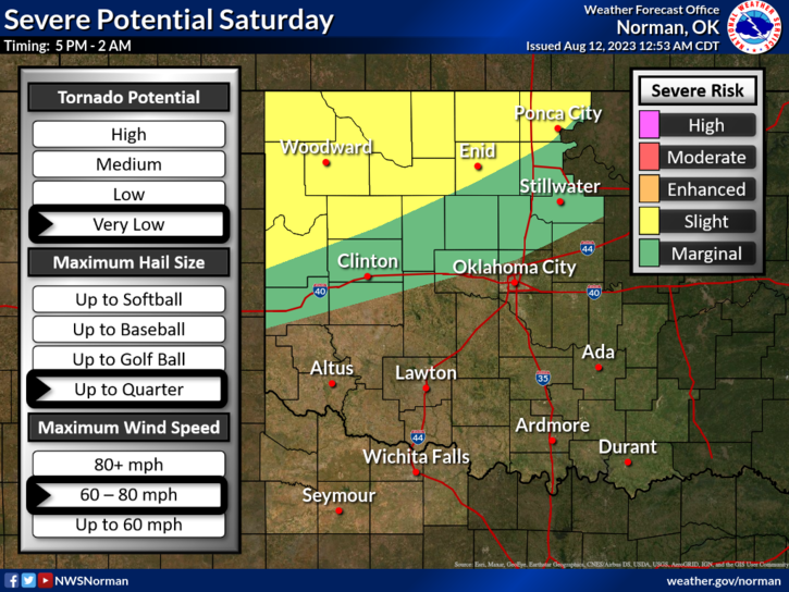
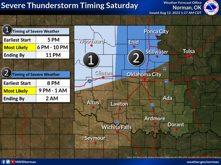
* SLIGHT RISK FOR SEVERE STORMS THIS EVENING. TIMING: ROUGHLY FROM 8-9PM THRU 0100 EARLY SUNDAY MORNING. GOLF BALL SIZE HAIL & WINDS 60-80 MPH ARE THE MAIN THREATS. These storms will originate off the high plains of either or both Colorado/New Mexico. Winds will our number 1 threat tonight. That stated, the Mesonet site, 7 west of Watonga had a 94 mph wind gust last night. Storms tonight will produce very strong outflow winds so be prepared.
* Fire Danger for us, is slowly climbing out there. Be sure to call in any controlled burns to dispatch at 580-234-FIRE (3473).
*Overall, we’ll be ok. Here is your forecast from the NWS/NORMAN;
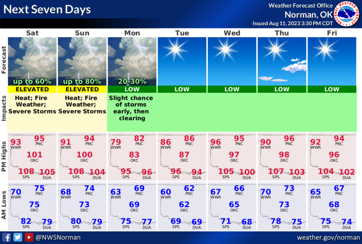
Today-Partly sunny. A slight chance of showers and thunderstorms. Some thunderstorms may produce damaging winds this afternoon. Highs in the mid-90s. Southeast winds 5 to 10 mph. Chance of rain 20 percent. Heat index values up to 108 this afternoon.
Tonight- Showers and thunderstorms likely. Some thunderstorms may be severe with damaging winds. Humid with lows in the lower 70s. Southeast winds 10 to 15 mph, becoming northeast 5 to 10 mph after midnight. Chance of rain 60 percent. Heat index values up to 107 early in the evening.
*Download our GARFIELD COUNTY EM app and click on the GCEM Blog icon. The information here is also located on the front page of our website at https://gcem.org
HAVE A GOOD DAY!