0410L-SATURDAY OUTLOOK FROM GARFIELD COUNTY EMERGENCY MANAGEMENT-8/29/2020
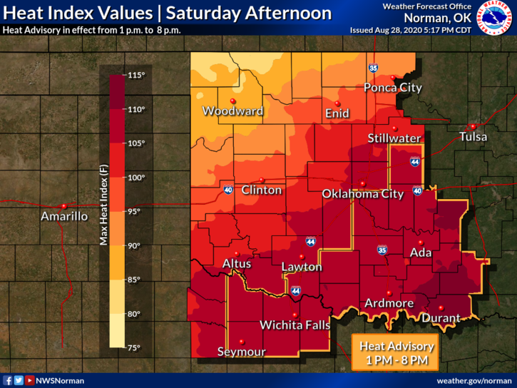
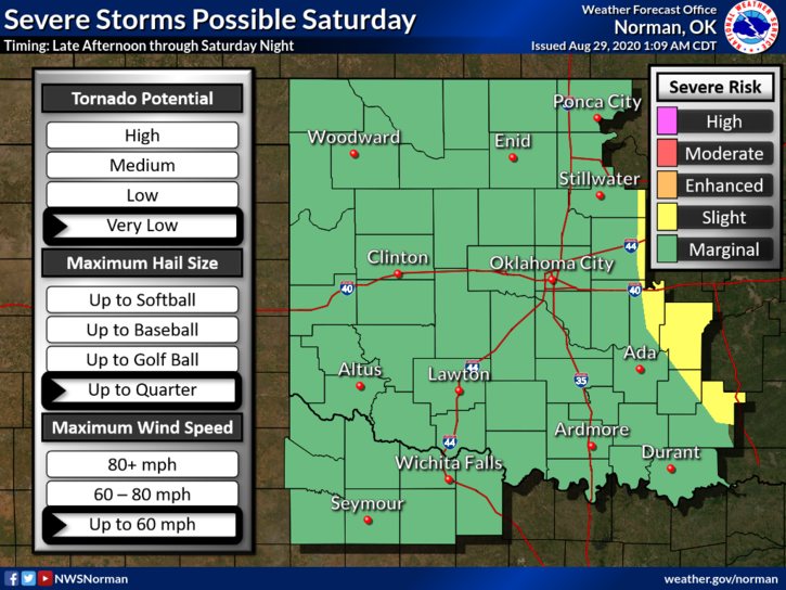
1- MARGINAL RISK for severe weather here later today into tonight and on Sunday. If you travel south today, there is an EXCESSIVE HEAT WARNING south of roughly a Sulphur to Holdenville line per guidance. We should be near the frontal boundary today with that risk for storms and our high temps should be in the upper 80s. It all depends on where the front wants to hang out.
2- A wind shift will occur with the front bringing in wind gusts possibly upwards of 45-50 mph. Timing is roughly an hour or two. It’s 0350 as I type. Overall, we’ll be ok. Secure anything that could take flight just in case.
3- Here is your forecast from the NWS/NORMAN;
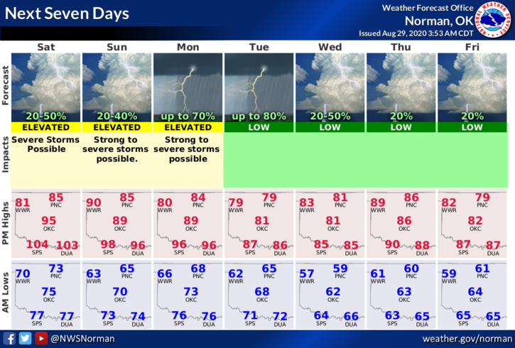
Today-Scattered thunderstorms early in the morning, then a slight chance of thunderstorms later in the day. Highs in the upper 80s. Northeast winds 10 to 15 mph. Chance of thunderstorms 30 percent.
Tonight-Mostly cloudy with a chance of thunderstorms. Lows in the mid-60s. Northeast winds 10 to 15 mph. Chance of thunderstorms 40 percent.
FINALLY, I haven’t been able to post graphics for some reason on my EM page. I can post on my personal page. If you want to see the whole post, go to www.gcem.org and it appears on the front page of our website. It’s also on the GARFIELD COUNTY EM app under the BLOG icon. Beginning September 1st, I won’t be posting daily on Facebook. My website is more reliable as is our app. We will continue doing live broadcasts here, if needed, until we get our other venue operational. More info on this Sunday and Monday.
HAVE A GOOD DAY!
MIKE