0400L-SUNDAY OUTLOOK FROM GARFIELD COUNTY EMERGENCY MANAGEMENT-8/30/2020
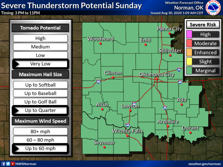
1-MARGINAL RISK for possibly some severe weather later today. If storms occur, quarter size hail and winds to 60 mph are the threats. The tornado potential is very low. Monday, as it looks right now, the severe threat will be south and east of us. Overall, we’ll be ok.
2- Here is your forecast from the NWS/NORMAN;
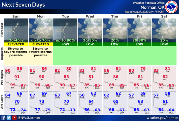
Sunday-30 percent chance of showers and thunderstorms before 10am. Cloudy, then gradually becoming mostly sunny, with a high near 88. Light and variable wind becoming south 5 to 8 mph in the morning.
Sunday Night-20 percent chance of showers and thunderstorms before 4am. Partly cloudy, with a low around 69. Southeast wind 7 to 9 mph.
DIRECTORS COMMENT
Several folks have text me and ask why the move? Here are a few reasons:
1- Continual changes keep hindering our ability to post information. Graphics apparently aren’t allowed anymore on my EM page. NOTHING has changed on our end. I can post them on my personal page but that’s it.
2-I’ve decided that you all can click the link I provide and see it all with no restrictions at www.gcem.org . If you have our GARFIELD COUNTY EM app, just click the GCEM BLOG icon and you’ll see it. Most folks don’t see our post anymore anyways so this will assure you get to see it and actually venture off of social media.
3-Hope this doesn’t shock anyone. We’ll continue to do live on Facebook if needed but we are looking into another venue there too. I’ll keep you updated. These changes go into effect TUESDAY MORNING.
HAVE A SUPER DAY!!
MIKE