0350L-SATURDAY OUTLOOK FROM GARFIELD COUNTY EMERGENCY MANAGEMENT-12/28/19
GARFIELD COUNTY EM is our notification app. You’re not prepared without it!
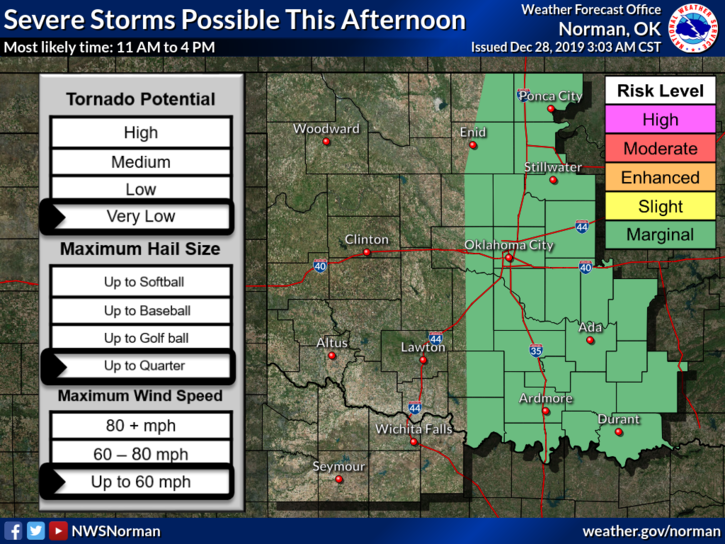
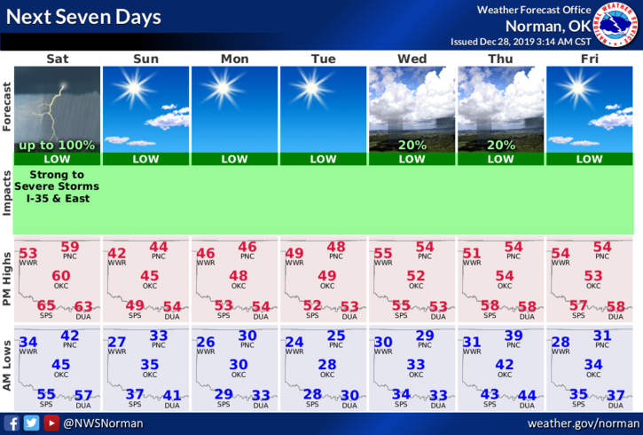
1- MARGINAL RISK for SEVERE weather this afternoon. “If” storms occur here, quarter size hail, winds to 60 mph, & intense lightning are the main threats. The tornado threat is very low. This said the Storm Prediction Center feels that the main area for severe weather will be east of the I-35 corridor. We will have a dryline involved so once it goes by, our threats go down. We also have a cold front in the picture so keep that in mind too. As far as I’m concerned, it’s close enough to warrant the saying, STAY WEATHER AWARE THIS AFTERNOON.
2- Overall, we’ll be ok as the threat for severe weather will occur mostly during the afternoon hours. Just keep in mind folks that we can have severe weather anytime of the year when the right conditions come together. Today is one of those days. We’ll watch and advise.
3- Here is your forecast from the NWS/NORMAN;
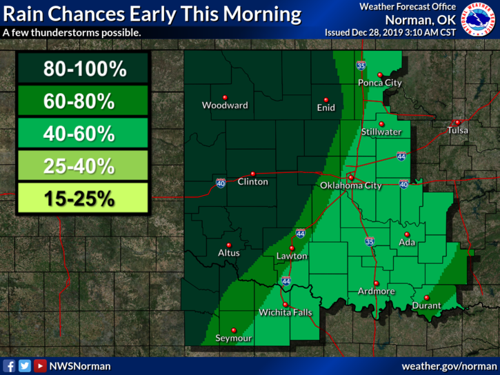
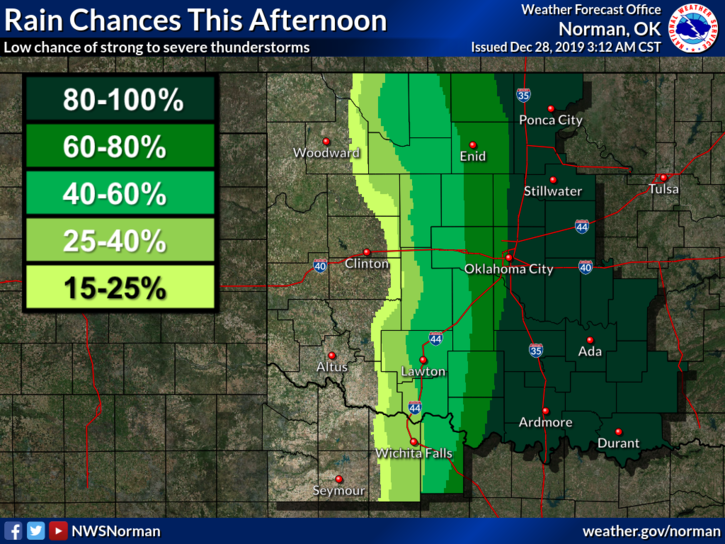
Today-Rain and possibly thunderstorms. High near 57. South southeast wind 10 to 20 mph becoming southwest in the afternoon. Winds could gust as high as 24 mph. Chance of precipitation is 100%. New rainfall amounts between a quarter and half of an inch possible.
Saturday Night-Low around 31. West winds around 10 mph becoming northwest after midnight.
HAVE A GOOD DAY!!
MIKE