0355L-SATURDAY OUTLOOK FROM GARFIELD COUNTY EMERGENCY MANAGEMENT-2/23/19
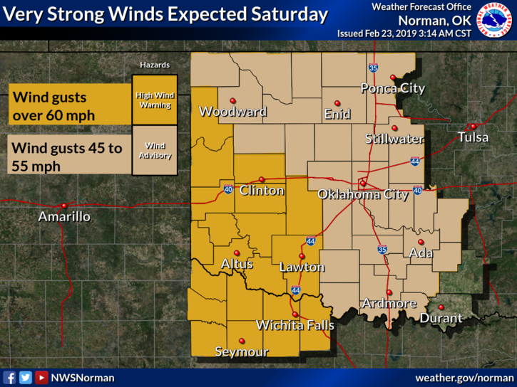
1) WIND ADVISORY IN EFFECT FOR US FROM 6 AM UNTIL 6 PM TONIGHT WINDS 25-35 MPH WITH GUSTS TO 50 MPH ARE POSSIBLE.
2) HIGH WIND WARNING IN EFFECT FOR SOUTHWEST OKLAHOMA FROM 6AM-6PM. WINDS 30-40 GUSTING TO 60 ARE POSSIBLE.
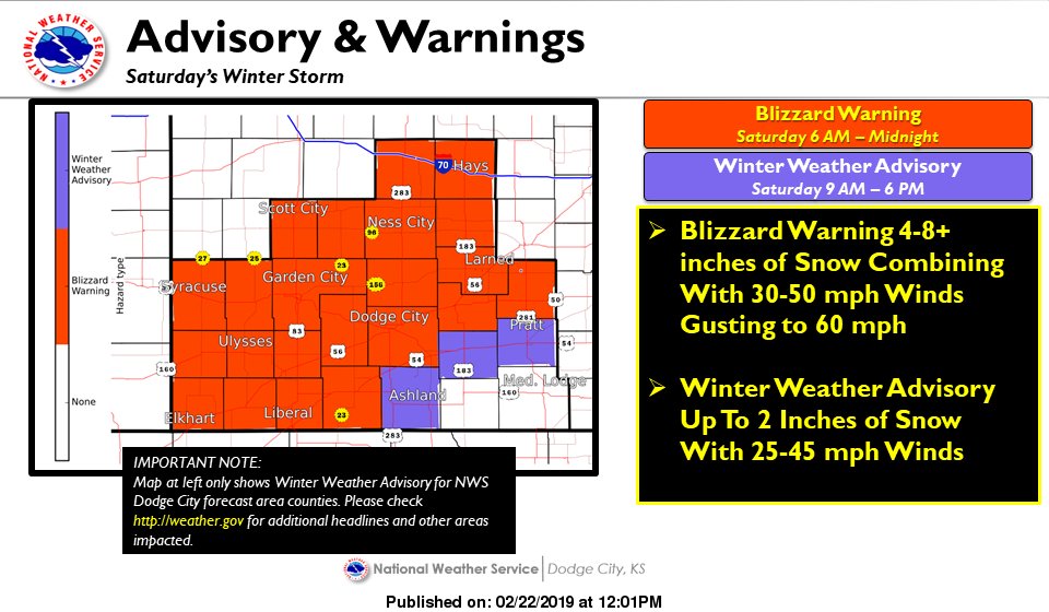
3) BLIZZARD WARNING IN EFFECT FOR WESTERN KANSAS FROM 6AM UNTIL MIDNIGHT TONIGHT.
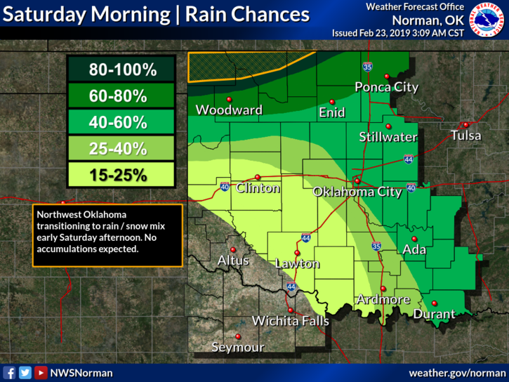
4) Probably not a good day for traveling into some of these areas today. We can expect rainy conditions as a storm system pushes thru the area. A cold front will push thru this afternoon bring dryer and colder air along with very strong winds. Secure anything that could take flight at work and at home.
5) Other than the above, we’ll be ok so enjoy the day and we’ll advise if needed over our GARFIELD COUNTY EM APP.
6) Here is your forecast from the NWS/NORMAN;
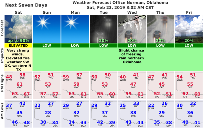
Today- Patchy fog early in the morning. Cloudy with rain showers likely with possible thunderstorms and drizzle early in the morning, then partly cloudy with a slight chance of rain late in the morning. Partly cloudy in the afternoon. Windy. Not as cool. Highs in the upper 50s. South winds 20 to 30 mph shifting to the west around 30 mph in the afternoon. Gusts up to 45 mph. Chance of precipitation 70 percent.
Tonight-Clear, windy, colder. Lows in the mid 20s. Northwest winds 20 to 30 mph decreasing to 10 to 15 mph after midnight.
HAVE A GOOD DAY!!
MIKE