0303L-SATURDAY OUTLOOK FROM GARFIELD COUNTY EMERGENCY MANAGEMENT 02/24/24
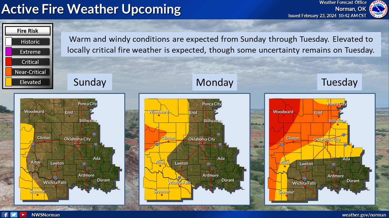
*Looks like the next 4 days will be warm with temps in the 70s over the weekend and possibly the low 80s by mid-day Monday. Winds should average 5-10 mph over the weekend and then we’ll see an increase on Monday through Tuesday with gusts upwards of 25 – 40 mph on Tuesday. Tuesday evening, a cold front pushes in and drops temps back down into the 40s and low 50s for highs. This said, the FIRE DANGER is Elevated over the weekend and goes Critical Monday and Tuesday. We’ll know more as the weekend progresses.
*For now, just enjoy the weekend and enjoy the warmth. Prepare for high winds Monday and Tuesday. OVERALL, we’ll be ok so here is your forecast from the NWS/NORMAN;
Today-Sunny. Highs around 70. West winds around 5 mph, becoming southwest with gusts up to 20 mph this afternoon.
Tonight-Mostly clear. Lows in the lower 40s. South winds 5 to 10 mph.
FINALLY, an update is coming to several channels on the GARFIELD COUNTY EM app. When the update occurs, I’ll make known what the codes are for the protected channels to the respective emergency services folks. There won’t be changes for the public at this time.
HAVE A GOOD DAY!