0330L-SATURDAY OUTLOOK FROM GARFIELD COUNTY EMERGENCY MANAGEMENT 01/20/24
*It appears we’ll be mostly sunny but winds will keep that chill in the air. The winds won’t be out of control but even at 5-10 mph, it will still be a bit bitter out there so continue to stay covered up while outdoors.
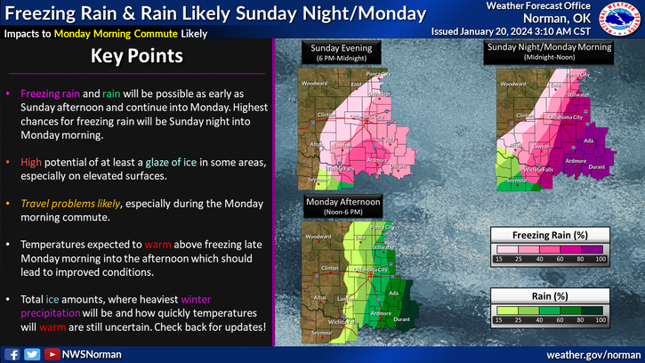
*We will continue warming slowly and on Sunday, we begin a transition from very cold to warmer temps. A storm system is coming that will bring rain/freezing rain to the region. Our chances here look low per guidance BUT AGAIN, we’ll watch this closely. Traveling east or south-southeast later on Sunday, overnight into Monday will be hazardous due to ice so make sure your plans don’t include sliding off the roads and be prepared accordingly.
*Temps Sunday night will drop to around freezing and we’ll warm up into the mid-30s by late Monday morning so any freezing precip that we may have received will melt. Any other precip on Monday should be rain. Monday nights low looks to remain ABOVE freezing. Looking forward to that.
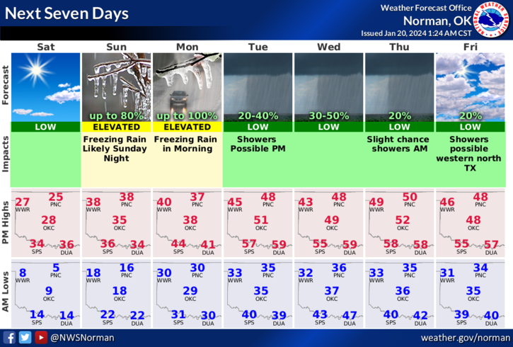
*Overall, for today, we’ll be ok so here is your forecast from the NWS/NORMAN;
Today- Sunny, cold with highs in the mid-20s. East winds 5 to 10 mph. Wind chill values as low as 1 below this morning.
Tonight- Mostly cloudy. Cold with lows around 17. Southeast winds 5 to 10 mph.
STAY WARM AND HAVE A GOOD DAY!