0330L-SATURDAY OUTLOOK FROM GARFIELD COUNTY EMERGENCY MANAGEMENT-7/31/21
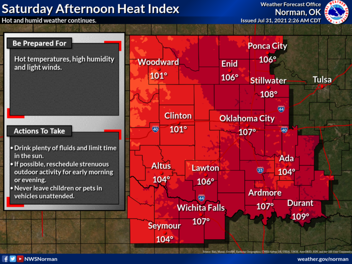
1-HEAT ADVISORY IN EFFECT FROM 11AM UNTIL 9PM TONIGHT. We are also in a GENERAL T-STORM RISK AREA. A cold front will be pushing into the area later tonight bringing a “chance” for thunderstorms. If any storms do occur, the severe threat would be downdraft winds and hail. We’ll see what happens.
2- The heat index will be up there once again today. Use extreme caution if you have to do any work outdoors and pace yourselves and stay hydrated. Check on your pets too. This type of heat will stress your animals too. The front that will come through will bring drier air but temps will remain around 90 or so. Overnight temps will average in the mid to upper 60s.
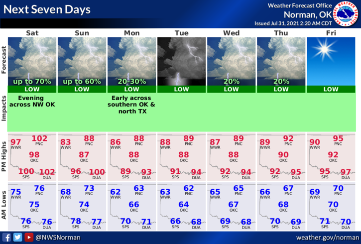
3- Overall, we’ll be ok. Be careful outdoors and enjoy the heat. Just think, in 4 to 5 months it might be cooler! Here is your forecast from the NWS/NORMAN;
Today-Sunny and hot, with a high near 102. Heat index values as high as 106. South southwest wind 5 to 15 mph, with gusts as high as 20 mph.
Tonight-50 percent chance of showers and thunderstorms, mainly after 1am. Partly cloudy, with a low around 71. South wind 5 to 10 mph becoming north northeast after midnight.
HAVE A GOOD DAY!!
MIKE