0230L-SUNDAY OUTLOOK FROM GARFIELD COUNTY EMERGENCY MANAGEMENT-8/01/21
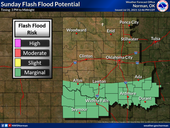
A FLOOD ADVISORY HAS BEEN ISSUED FOR GARFIELD COUNTY AT 0225 LOCAL TIME. WE HAVE RECEIVED SEVERAL INCHES OF RAIN IN A SHORT TIME SO FLOODING IN LOW LYING AREAS IS HIGHLY POSSIBLE.
1-The front has arrived and we have had quite a bit of rainfall in the last few hours. Let me know what your rainfall totals are after the rain ends.
2- We will remain in a GENERAL THUNDERSTORM RISK AREA through the early morning as the front sinks farther south and then we’ll see clearing skies later this morning and into this afternoon. The southern part of the state might see some thunderstorm activity later this afternoon.
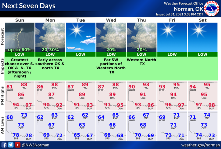
3- We’ll see temps in the upper 80s today with much drier air so it will be a bit milder than the heat from yesterday. That said, here is your forecast from the NWS/NORMAN;
Sunday-Partly cloudy. A chance of thunderstorms in the morning. Not as warm. Highs in the upper 80s. Northeast winds around 10 mph. Chance of thunderstorms 50 percent.
Sunday Night-Clear. Lows in the lower 60s. Northeast winds up to 10 mph in the evening becoming light and variable.
HAVE A GOOD DAY!
MIKE