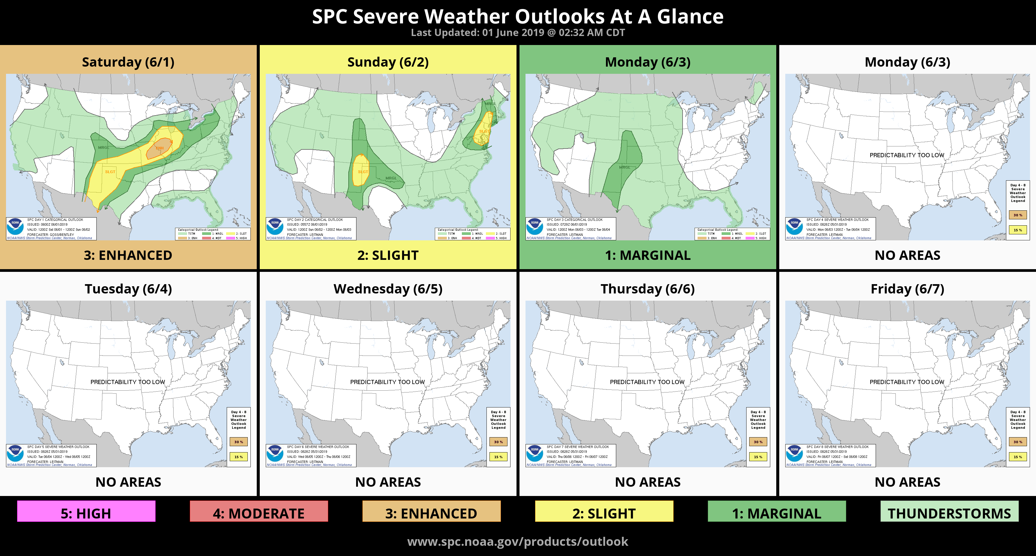
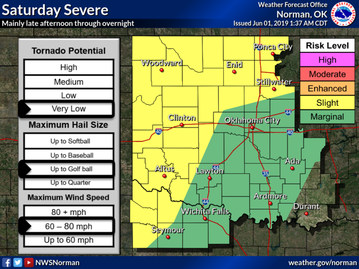
0415L-SATURDAY OUTLOOK FROM GARFIELD COUNTY EMERGENCY MANAGEMENT-6/1/19
1- SLIGHT CHANCE FOR SEVERE WEATHER LATER TODAY AND TONIGHT. Don’t panic, these storms will be a wind and hail threat. The tornado threat is EXTREMELY low. Once again I am worried about the flood risk as any storm over the area will have the potential for torrential rainfall meaning a possibility for flash flooding.
2- REMINDER- A WATCH means conditions are conducive for severe weather. It’s not happening right now but probably will later. A WARNING means severe weather is happening now so take the proper precautions to protect yourself and your family until the warning is over. Some folks don’t understand that during the WATCH, its ok to continue your plans. Just keep an eye to the sky and if threatening weather is coming, take the proper steps. It’s not complicated.
3- Overall, we’ll be ok. No need to get upset. If anyone has a question concerning the weather or even a disaster question, email it to mike@gcem.org and I’ll get it answered. I don’t live on social media so if a question is sent there, it probably won’t get answered for a while. My email comes to my phone!!
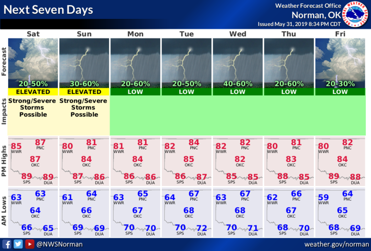
4- Here is your forecast from the NWS/NORMAN;
Saturday-Partly cloudy. A slight chance of thunderstorms in the morning, then a chance of thunderstorms in the afternoon. Highs in the upper 80s. Southwest winds around 10 mph. Chance of thunderstorms 30 percent.
Saturday Night-Mostly cloudy with a chance of thunderstorms. Lows in the mid 60s. Light and variable winds. Chance of thunderstorms 50 percent.
HAVE A SUPER DAY!!
MIKE