0350L-SATURDAY OUTLOOK FROM GARFIELD COUNTY EMERGENCY MANAGEMENT-3/30/19
1-SEVERE THUNDERSTORM WATCH 35 that was in effect until 8 am has been allowed to expire for our area.
2- Thunderstorms overnight here in the area weren’t severe but they did produce about ¼ inch of rainfall.
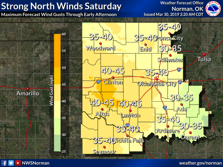
3- For today, colder with strong northerly winds. They should die down later this afternoon but you will definitely notice the colder air so dress appropriately.
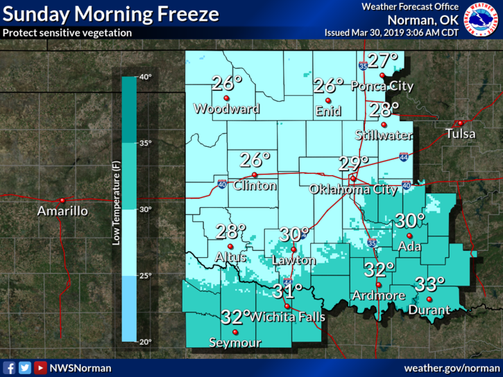
4- Tonight, we will have a killing freeze so cover anything you planted and bring in potted plants. It wouldn’t hurt to protect your outside animals too.
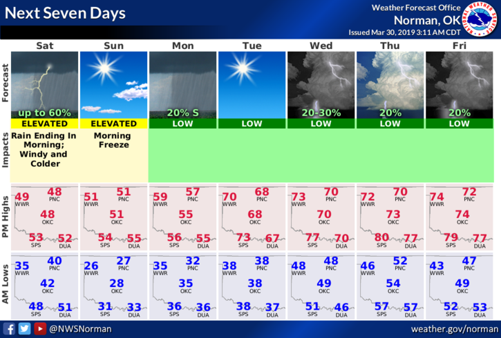
5- Here is your forecast from the NWS/NORMAN;
Saturday-30 percent chance of showers before 7am then mostly cloudy with a high near 48. Windy with a north wind 25 to 30 mph with gusts as high as 40 mph.
Saturday Night-Mostly clear with a low around 26. North wind 8 to 18 mph, with gusts as high as 25 mph.
HAVE A GREAT DAY and dust off your coats!!
MIKE