0355L-FRIDAY OUTLOOK FROM GARFIELD COUNTY EMERGENCY MANAGEMENT-3/29/19
Download our GARFIELD COUNTY EM app. You’re better prepared with it than without it.
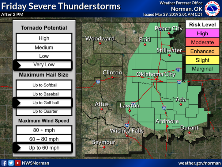
1-We are in a MARGINAL risk for severe weather today. Hail and wind will be our main threats if they do occur.
2- A cold front will push through this morning bringing with it some patchy drizzle. Upper support for this front is still out west. We’ll see what happens as the day progresses.
3- We are expecting thunderstorm development this evening and overnight. Main threats if storms occur will be hail and winds. Again, we’ll see what happens.
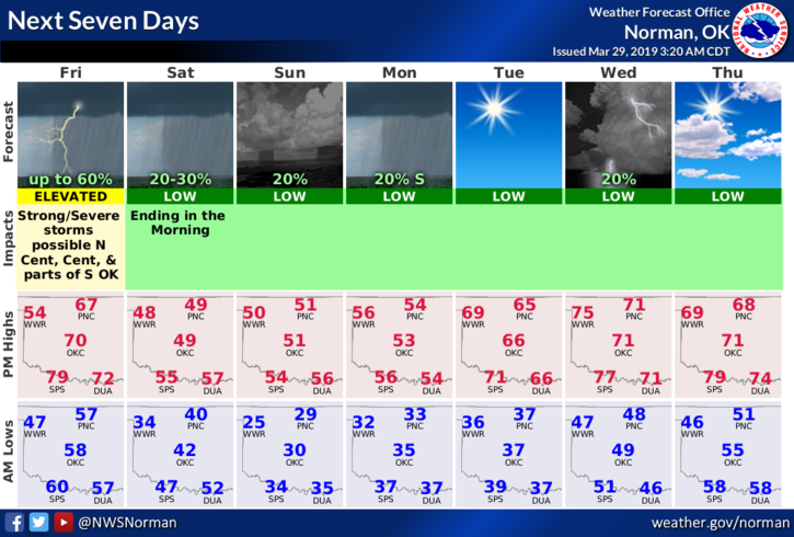
4- Here is your forecast from the NWS/NORMAN;
Friday- 40% chance for thunderstorms during the day. Cloudy with a high near 66. South winds 5 to 10 mph becoming northwest in the afternoon.
Friday Night-40% chance of showers and thunderstorms. Mostly cloudy with a low around 40. North wind 10 to 20 mph, with gusts as high as 25 mph.
Finally, as stated earlier this week, we are looking at possibly a killing freeze Sunday morning so cover or bring in those young plants if you planted early.
HAVE A GOOD DAY!!
MIKE