0310L-SATURDAY OUTLOOK FROM GARFIELD COUNTY EMERGENCY MANAGEMENT 03/30/24
*Winds will be light and out of the NE as temps gradually warm up. Dewpoint temps and Humidity will be up so the fire danger will be low, not out of the question but low. We should be partly cloudy so hopefully we’ll see some sunshine. Other than the above, not a bad day.
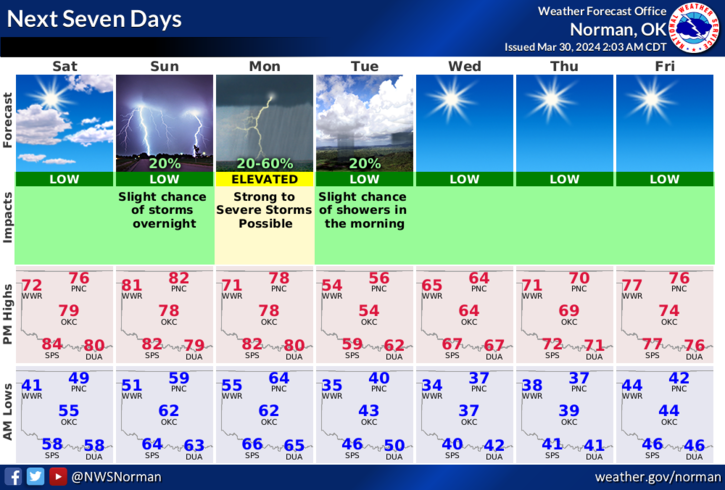
*Here is your forecast from the NWS/NORMAN;
Today- Partly sunny. Highs in the lower 70s. Northeast winds 5 to 10 mph.
Tonight- Mostly cloudy. Lows in the mid-50s. Southeast winds around 5 mph, becoming south 10 to 15 mph after midnight.
*Monday, we have a chance for severe weather. Storms may form on top of us, just to the west or just to the east. Be prepared as large hail and damaging winds are the main threats if they occur around us.
*Be sure to download our GARFIELD COUNTY EM app as you’ll receive advisories and warnings “directly” from the NWS, IN DETAIL. You’ll also receive information from us.
HAVE A GOOD DAY!