0420L-SATURDAY OUTLOOK FROM GARFIELD COUNTY EMERGENCY MANAGEMENT-3/9/19
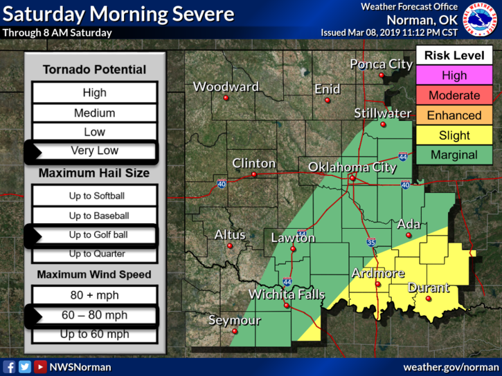
1-A lot happening this morning. It appears we may miss quite a bit of it but as stated in previous posts, if you plan to travel east, southeast, and or now south, check your forecasts along your route and at your destination. A GENERAL risk exists roughly at I-35. A MARGINAL RISK runs from Thackerville up through Tulsa, then northeast. The SLIGHT risk runs from just east of Dallas to Sallisaw then northeast out of the state. A SEVERE TSTM WATCH is in effect for the eastern 1/3rd of the state until 10am. In some areas, it will be extended. Like I said, check your forecast if you plan to travel.
2- For us, we may see some strong wind gusts out of the west/southwest this morning and then a front will push in later today. Overall, we’ll be ok.
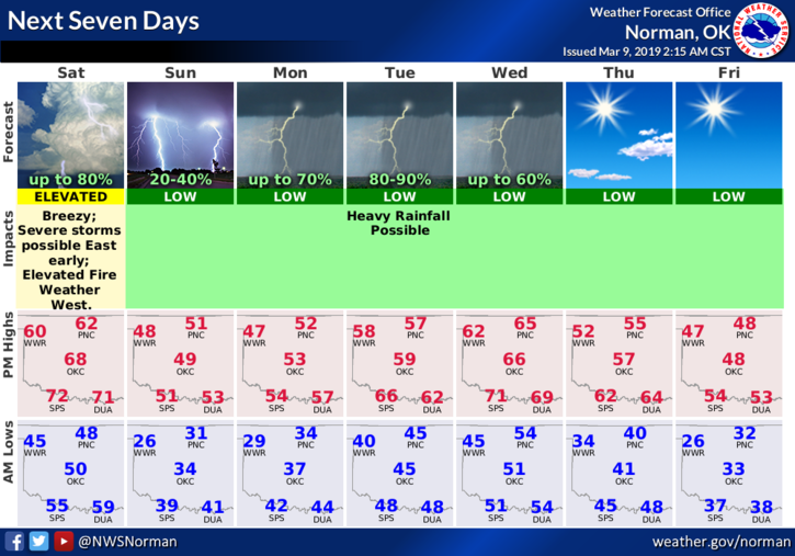
3- Here is your forecast from the NWS/NORMAN;
Saturday-20 percent chance of showers before 9am. Sunny, with a high near 63. Windy, with a southwest wind 18 to 28 mph becoming northwest in the afternoon. Winds could gust as high as 39 mph.
Saturday Night-Increasing clouds, with a low around 31. North wind 6 to 16 mph, with gusts as high as 23 mph.
4- Stay prepared with our GARFIELD COUNTY EM app. If you don’t have it, YOU’RE not prepared.
HAVE A GOOD DAY!!
MIKE