0300L-SATURDAY OUTLOOK FROM GARFIELD COUNTY EMERGENCY MANAGEMENT 5/13/23
**Be sure to download our GARFIELD COUNTY EM app. You’re not prepared without it.
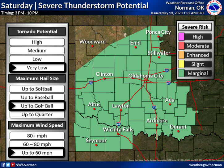
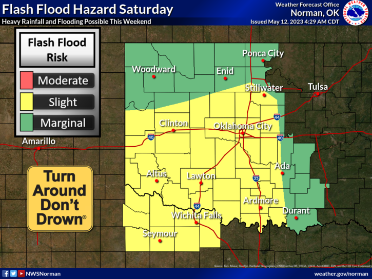
* At 0240L, a cold front is creeping our way and will stall out in our area and could possibly creep back to the north as a warm front. It’s the reason we haven’t see any rain YET. Meanwhile, an upper low in SW Texas is lifting north and will bring with it sub-tropical moisture. This said, we will stand a chance for severe thunderstorms this afternoon with hail and winds being the main threats. Heavy rainfall will become the primary threat over the weekend.
* Per guidance, the atmosphere will be unstable today thus the severe risk. If we do receive the rainfall that is forecast, we may see some flooding, especially in low lying areas so use EXTREME CAUTION while driving, once the rain begins. It is the weekend so keep the kids out of any rushing water in the creeks as higher water levels may bring out the snakes and other critters. We don’t want to see any kids swept downstream or bitten by those critters.
*Overall, we should be ok but we MAY see a lot of rainfall. Just be careful. Here is your forecast from the NWS/NORMAN;
Today- Partly sunny. A slight chance of showers and thunderstorms this morning, then a chance of showers and thunderstorms this afternoon. Highs in the lower 80s. Northwest winds 5 to 10 mph, becoming east this afternoon. Chance of rain 40 percent.
Tonight- Mostly cloudy with a chance of thunderstorms. A chance of showers in the evening, then showers likely after midnight. Lows in the lower 60s. Southeast winds 5 to 10 mph. Chance of rain 70 percent.
HAVE A GOOD DAY