0415L-FRIDAY OUTLOOK FROM GARFIELD COUNTY EMERGENCY MANAGEMENT 5/12/23
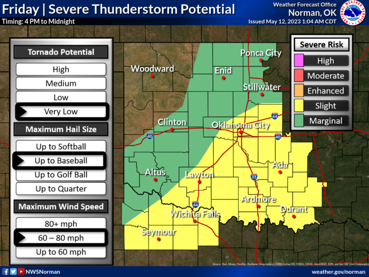
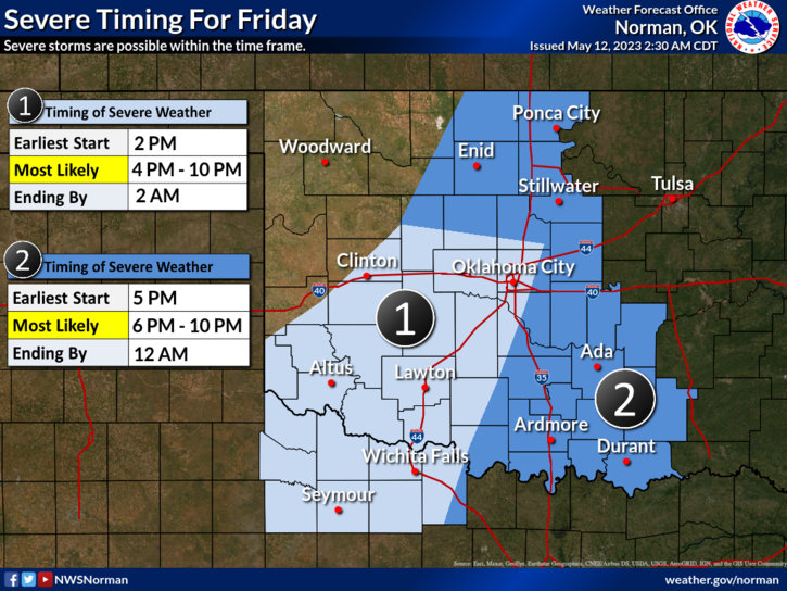
* We are in a MARGINAL RISK area for thunderstorms today. See graphic attached. We are expecting a cold front that will push into the area today or tonight and it will intersect the dryline out west. Where these boundaries meet to the south and east will be the areas of concern for additional severe storms. Timing of storms for us, see 2nd graphic, will be 6pm to 10pm. Remember that these graphics will change several times during the day. There are still several variables going on. After reading the SPC OUTLOOKS, NWS-WICHITA, AND NWS-NORMAN DISCUSSIONS, they are all just a little bit different so I will stay with the graphical hourly forecast and we’ll see what happens.
* Starting tonight, we’ll have a chance for showers and thunderstorms for the next 4-5 days.
*Overall, we’ll be ok, Here is your county-wide forecast from the NWS/NORMAN;
Today-Mostly sunny. Highs in the upper 80s. Southwest winds 10 to 15 mph.
Tonight-Mostly cloudy with a chance of showers. A slight chance of thunderstorms in the evening, then a chance of thunderstorms after midnight. Lows around 60. South winds 10 to 15 mph, becoming west 5 to 10 mph after midnight. Chance of rain 40 percent.
Keep an umbrella handy and have a good day!