0400L-SATURDAY OUTLOOK FROM GARFIELD COUNTY EMERGENCY MANAGEMENT-5/25/19
FLOOD WARNING IN EFFECT THROUGH SATURDAY NIGHT. THIS MAY BE EXTENDED.
GARFIELD COUNTY EM = PEACE OF MIND. LOCAL INFO ALONG WITH PUSH WARNINGS FROM THE NWS.
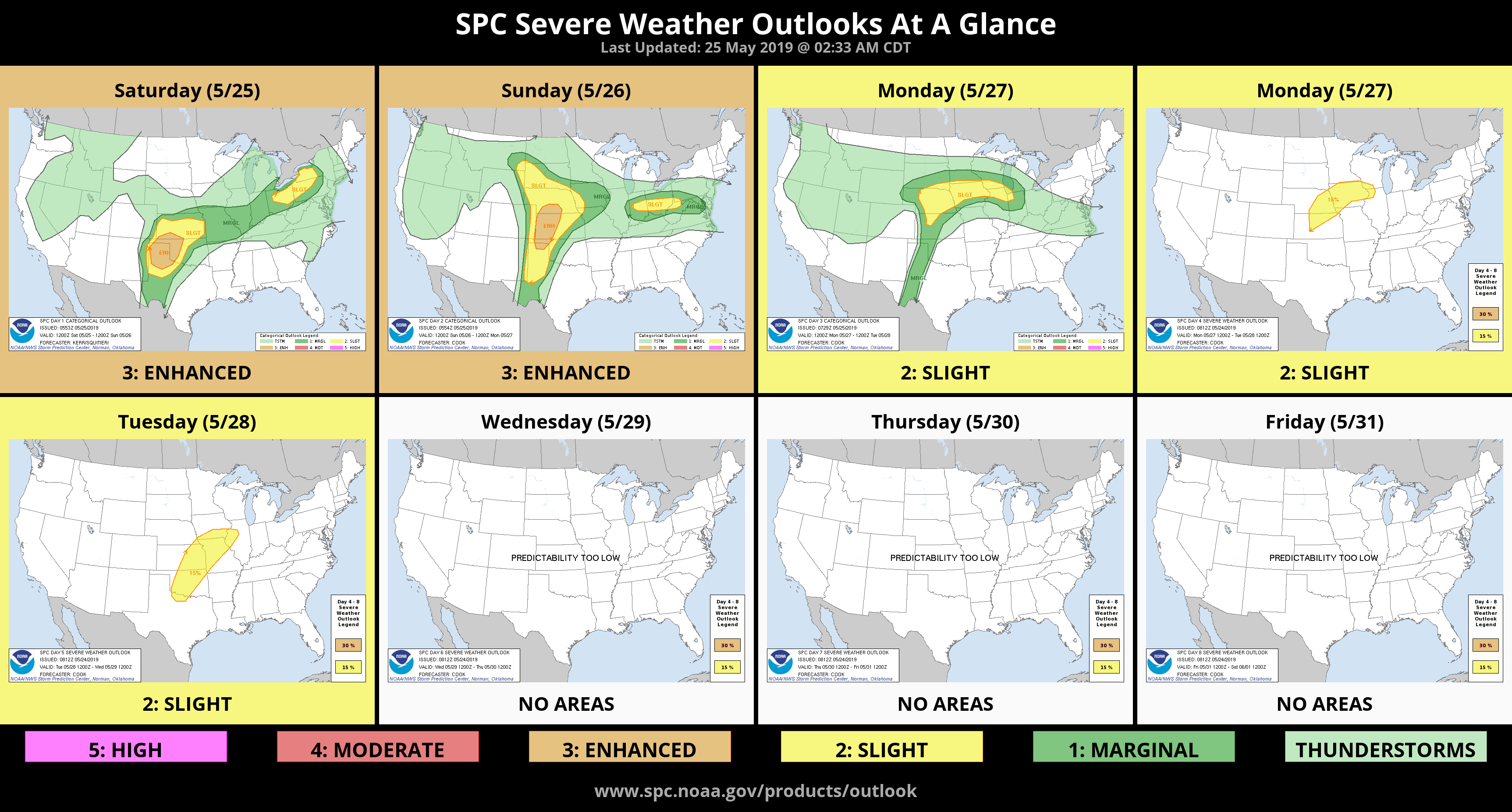
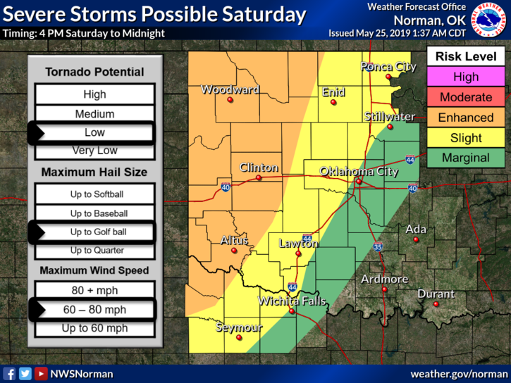
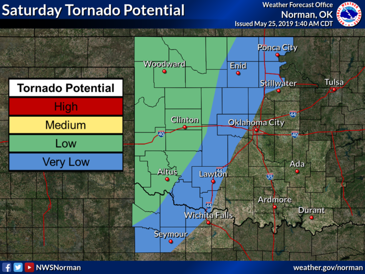
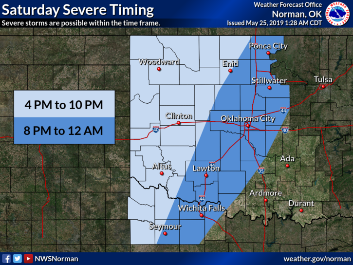
1- Without sounding like a broken record, there is a risk for severe weather later today. See graphic. Spotters and water rescue teams are on stand-by in the event they are needed again.
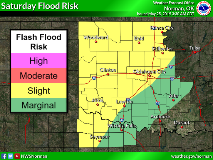
2- The risk for flooding will continue as the ground is saturated and any heavy rainfall will cause flash flooding. DO NOT drive through rushing water over roadways.
3- Depending where you were last night, we received anywhere from 1.5 inches to 3 inches of rain based on local reports. Some areas may have received more. Let us know. If you have our app, send your info through the “damage report.” Be sure to fill in all blanks. For those that don’t, email your reports and pics to us at mike@gcem.org, we’ll have a new email for this in a few days.
4- Here is your forecast from the NWS/NORMAN;
Saturday-Partly cloudy with a chance of thunderstorms. Highs in the lower 80s. South winds 15 to 20 mph. Chance of thunderstorms 40 percent.
Saturday Night-Mostly cloudy. Thunderstorms likely in the evening, then a chance of thunderstorms after midnight. Lows in the mid 60s. South winds around 10 mph. Chance of thunderstorms 60 percent.
HAVE A GREAT DAY!!
MIKE