0420L-SUNDAY OUTLOOK FROM GARFIELD COUNTY EMERGENCY MANAGEMENT-5/26/19
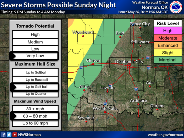
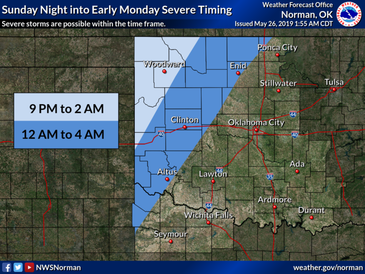
1- MARGINAL RISK for severe weather later today and tonight. See attached graphics
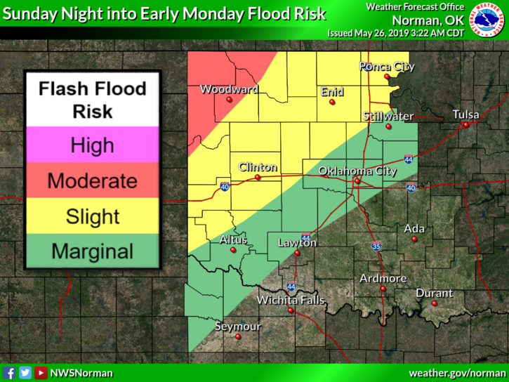
2- FLOOD WARNING IN EFFECT THROUGH MONDAY MORNING.
3- If anyone has sustained any damage from the winds last night, please send those reports into us through our app or email them to me at mike@gcem.org . On our app, it states name /address is optional, it’s not, please include your name, address, email, and phone number. THANK YOU.
4- Here is your forecast from the NWS/NORMAN;
Sunday-Partly cloudy. Highs in the lower 80s. South winds 10 to 15 mph.
Sunday Night-Mostly cloudy. A chance of showers and thunderstorms in the evening, then a chance of thunderstorms after midnight. Some thunderstorms may be severe in the evening. Locally heavy rainfall possible in the evening. Lows in the mid-60s. South winds around 10 mph. Chance of precipitation 50 percent.
HAVE A GOOD DAY!!
MIKE