0355L-FRIDAY OUTLOOK FROM GARFIELD COUNTY EMERGENCY MANAGEMENT-5/24/19
GARFIELD COUNTY EM = SECURITY; Knowing you’re getting information from your LOCAL EMERGENCY OFFICIALS.
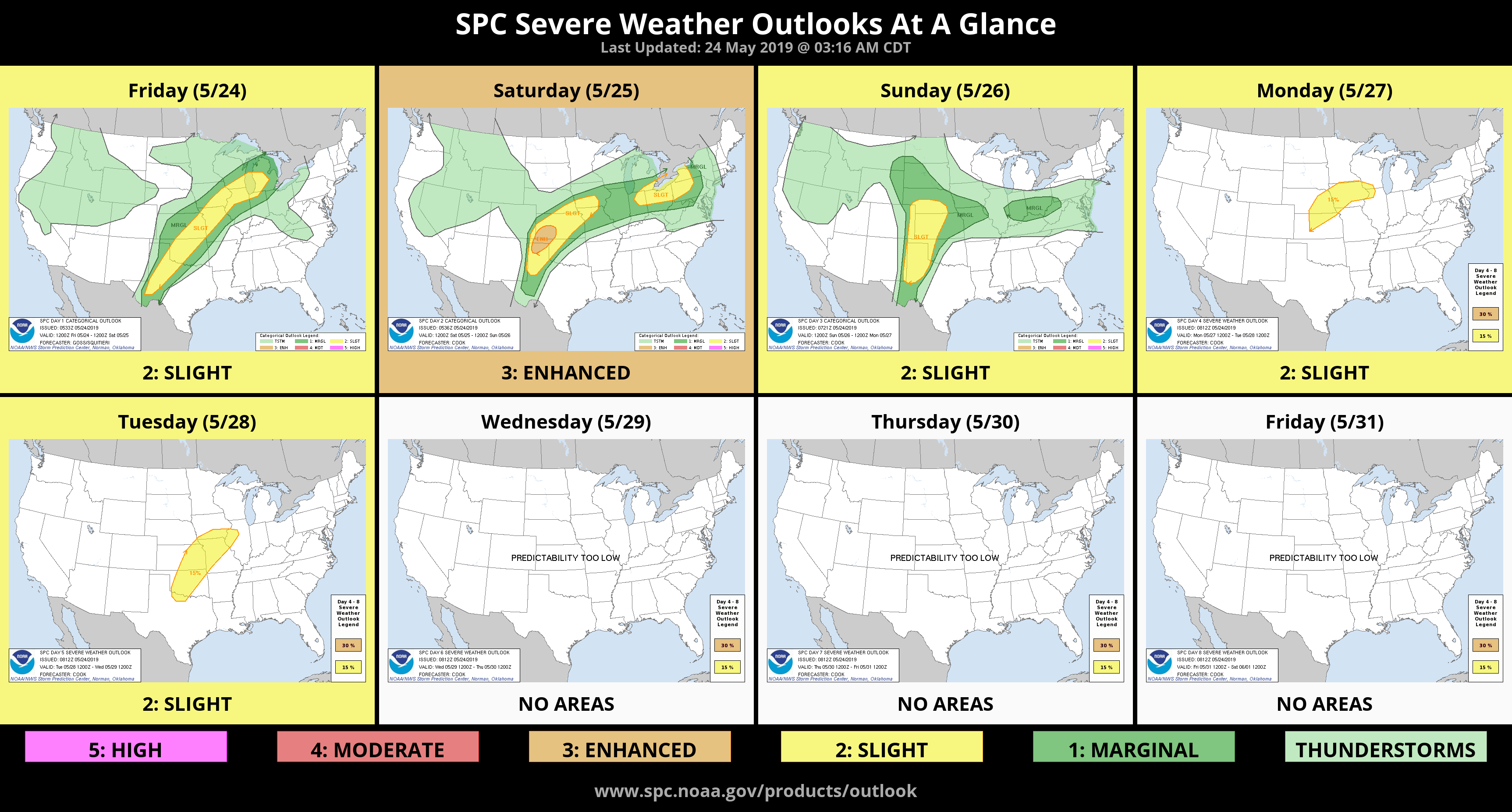
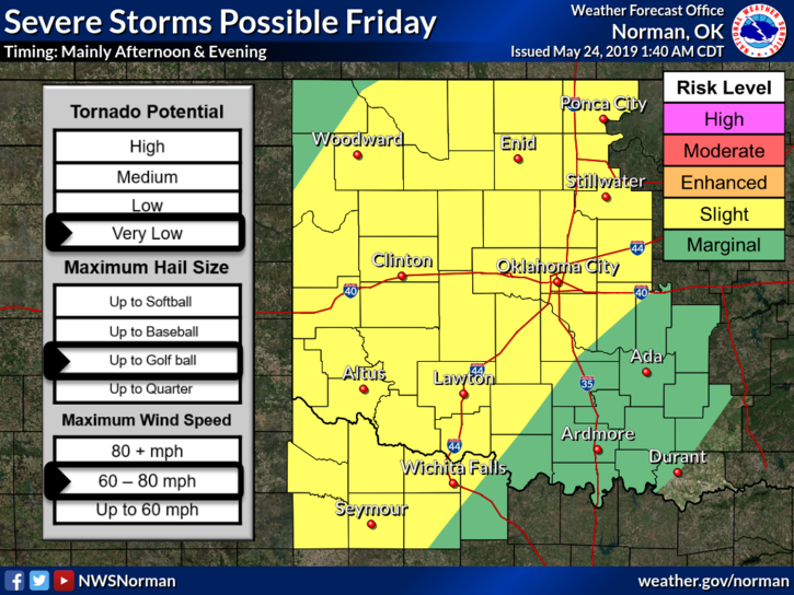
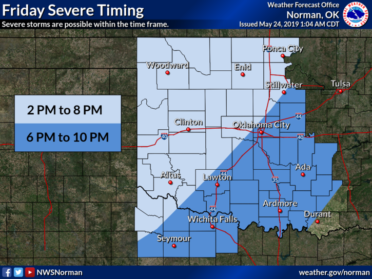
1- We are in a SLIGHT RISK for severe weather again today and over the weekend. All threats are possible but torrential rainfall and flooding will be the main issues. We are in a FLOOD WATCH TOO. Pay close attention to conditions as the weekend gets underway.
2- EXTREME CAUTION is advised for anyone traveling. ROAD CONDITIONS for OKLAHOMA and states “around” Oklahoma can be found on the front page of our gcem.org website. Check road conditions BEFORE leaving and I would advise not going site seeing for flood water without some sort of plan. Always remember-TURN AROUND, DON’T DROWN.
3- For those who were planning a weekend at the lake, depending on where you were going is whether you will be going or not. If worse comes to worse, just sit just inside the garage with the door open and listen to the sound of the falling rain. HMM, there is a song about that!!
4-Rain is on the way this morning so be careful out there. Here is your forecast from the NWS/NORMAN;
Friday-Cloudy, with a high near 78. South wind 10 to 15 mph gusting to 20 mph. Chance of precipitation is 60%. New rainfall amounts between a half and three quarters of an inch possible.
Friday Night-40 percent chance of showers and thunderstorms, mainly before 1am. Low around 67. South winds around 10 mph.
I’ll advise over the GARFIELD COUNTY EM app and social media as needed.
HAVE A GOOD DAY!
MIKE