0255L-SATURDAY OUTLOOK FROM GARFIELD COUNTY EMERGENCY MANAGEMENT-5/27/23
*This post also appears on the GARFIELD COUNTY EM app under GCEM BLOG*
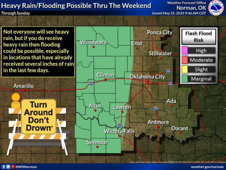
**We are in a GENERAL THUNDERSTORM risk area for today. As it appears per guidance right now, we may not see any rain as the areas with the higher risk are out in the Oklahoma/Texas panhandles. We will remain in this stagnant pattern, as stated in previous posts, for at least the next week or so and we will be closer to normal in temps, meaning around 80 degrees.
*The above stated, take a little time and go around the house or at work, outside and dump out any standing water. Mosquitoes need warm water to lay their eggs and we all know what happens when they hatch. The following is from yesterday: some drainage areas are full of water; snakes are roaming around now so keep the kids out of the water. If you live near any drainage areas, keep that eye out for those sneaky critters. They will surprise you when you least expect it.
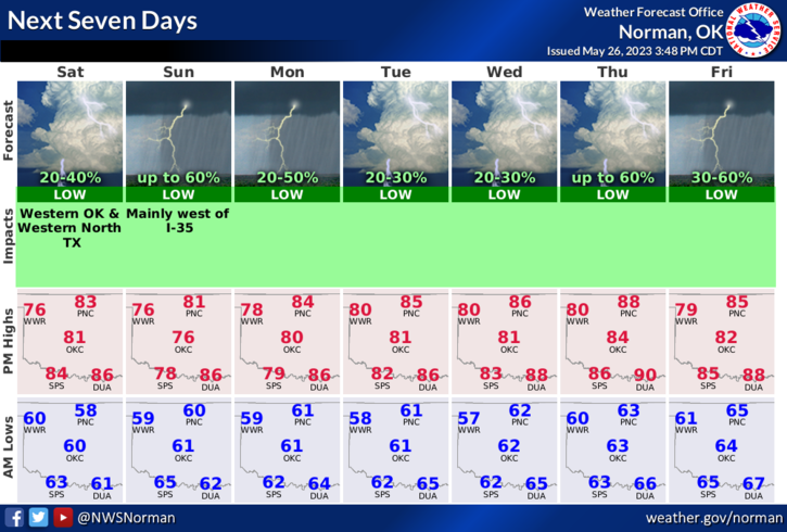
*Overall, we’ll be ok so here is today’s forecast from the NWS/NORMAN;
Saturday-Mostly sunny. Highs in the lower 80s. Southeast winds 5 to 10 mph.
Saturday Night- Mostly cloudy. Lows in the lower 60s. Southeast winds 5 to 10 mph.
HAVE A GOOD DAY!