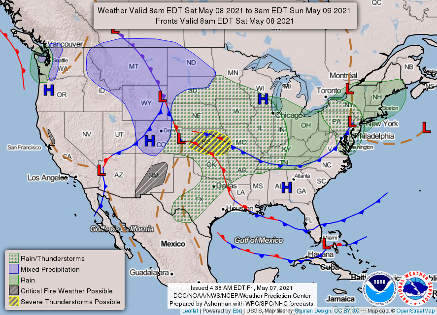
0400L-SATURDAY OUTLOOK FROM GARFIELD COUNTY EMERGENCY MANAGEMENT-5/8/21
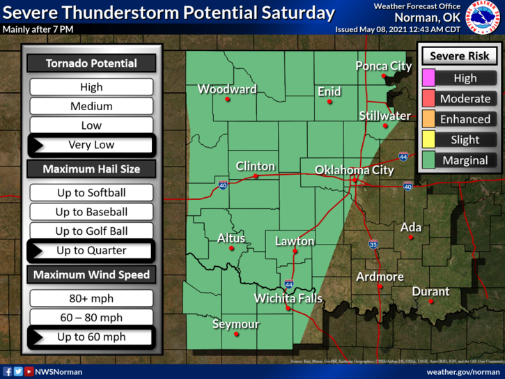
1- MARGINAL RISK for severe weather later this evening. Quarter size hail, 60 mph winds are the main threats. The tornado threat is very low.
2- The above said, we do have a strong capping inversion in the atmosphere that should keep any storms from happening during the day. Our chance will come as a cold front pushes into the area from Kansas sometime during the mid to late evening hours. The storm system involved will give Kansas some heavy weather later today so if you plan on traveling north, stay WEATHER AWARE.
3- Winds will be increasing with some wind gusts upwards of 35 mph. Be careful on east/west roads and please don’t text and drive. A sudden wind gust if you are not paying attention could cause an over-correction thus leading to an accident. Be careful. The fire danger is low but if you see any smoke or fire, call 911 immediately.
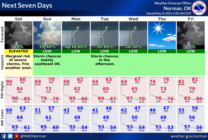
4- Here is your forecast from the NWS/NORMAN;
TODAY-Mostly sunny with a high near 87. South wind 10 to 15 mph increasing to 20 to 25mph in the afternoon. Winds could gust as high as 33 mph.
TONIGHT-Partly cloudy with a low around 56. South wind 15 to 25 mph becoming north northwest after midnight. Winds could gust as high as 32 mph.
FINALLY- The forecast will change some during the day. I will update this afternoon if parameters change but either way, stay weather aware for tonight.
HAVE A GOOD DAY!
MIKE