0350L-SATURDAY OUTLOOK FROM ENID/GARFIELD COUNTY EMERGENCY MANAGEMENT-11/24/18
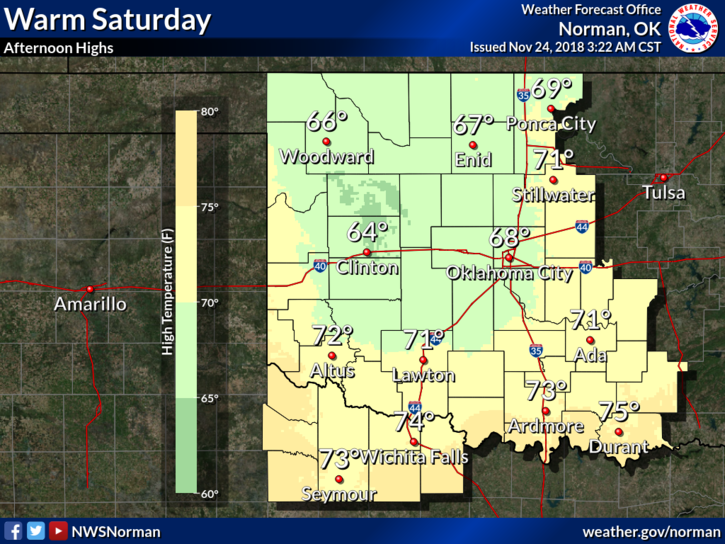
1- Early this morning we’ll enjoy light winds and by roughly mid-morning they will become southerly and stronger. We’ll also warm up into the upper 60’s so enjoy the day!! Tomorrow will be quite a bit different.
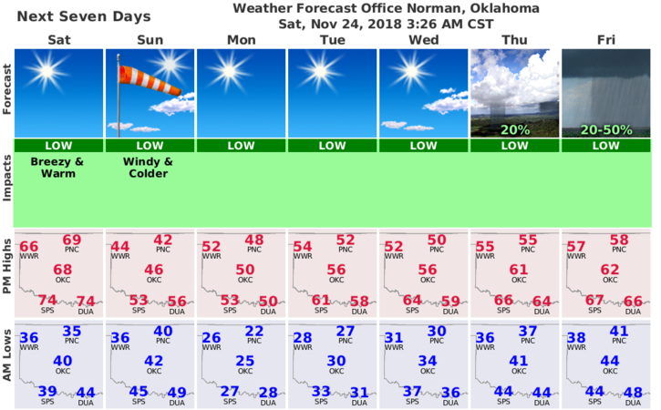
2- A cold front will push in overnight tonight shifting winds to the north. We may see wind gusts upwards of 40 mph on SUNDAY. You may want to check around the house, business, or wherever and secure anything that could take flight. As for precip, on Sunday, there MIGHT be some snowflakes/rain out there but we aren’t expecting anything major other than wind unless the storm track changes dramatically.
3- Now that foliage has died due to freezing temps, the FIRE DANGER becomes a major issue. As we stated all during last spring, if you see smoke or fire, call 911 immediately so response can be sent.
4- Here is your forecast from the NWS/NORMAN;
Saturday-Sunny, with a high near 68. Light and variable wind becoming south 10 to 15 mph in the morning. Winds could gust as high as 25 mph.
Saturday Night-Partly cloudy, with a low around 41. South wind 10 to 20 mph becoming northwest after midnight.
HAVE A GREAT DAY!!
MIKE