0415L-SUNDAY OUTLOOK FROM ENID/GARFIELD COUNTY EMERGENCY MANAGEMENT-11/25/18
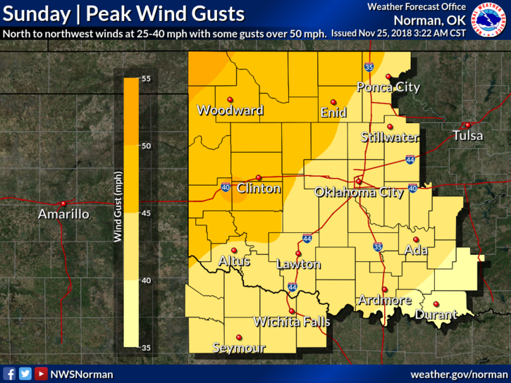
1- A WIND ADVISORY HAS BEEN ISSUED AND IS IN EFFECT UNTIL (1500L) 3PM. NW WINDS 25-35 MPH GUSTING UPWARDS OF 50 MPH ARE POSSIBLE. Use EXTREME CAUTION while driving due to strong crosswinds. ALSO- WIND CHILL temps in the 20’s will be an issue too.
2- If you are traveling in North Central and Northeastern Kansas today, expect possible blizzard conditions and drive using EXTREME CAUTION too. All that mess is moving east northeast towards SE Nebraska, SW Iowa, and NW Missouri.
3- Here is your forecast from the NWS/NORMAN;
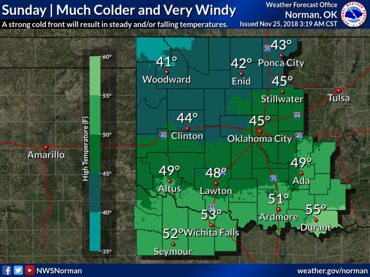
Today- Partly sunny with temperatures falling to around 36 by 5pm. Windy with north northwest winds 25 to 35 mph decreasing to 20 to 30 mph in the afternoon. Winds could gust as high as 47 mph.
Tonight-Clear with a low around 24. North northwest wind 10 to 20 mph decreasing to 5 to 15 mph after midnight. Winds could gust as high as 25 mph.
HAVE A SUPER DAY!
MIKE