0315L-SATURDAY OUTLOOK FROM GARFIELD COUNTY EMERGENCY MANAGEMENT-11/25/23
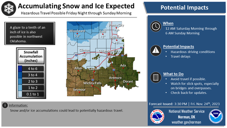
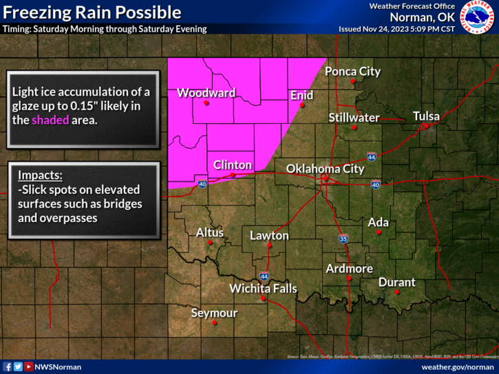
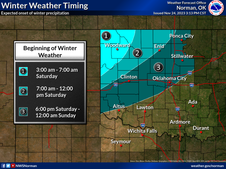
*TODAY is transition day. Rain is expected in the area from later this morning through this evening when colder air filters in and we transition to possibly some freezing rain and then to snow overnight. Accumulations could reach 1/10th of an inch of ice and maybe an inch or two of snow. There are still a few variables out there so just pay close attention to temps, wind, and especially road conditions. Bridges and overpasses will be the main threats for freezing road conditions.
*There is a WINTER WEATHER ADVISORY in effect west and northwest of us so again, if traveling, check with the nearest NWS office near your destination and slow down as conditions worsen. See the attached graphics for weather threats and timing. These will change a little during the day so go to this link and keep up with forecast conditions; https://www.weather.gov/oun/
*Overall, we’ll be ok, just cold. Here is your forecast from the NWS/NORMAN;
Today- Cloudy. A chance of freezing rain with a slight chance of rain this morning, then rain this afternoon. Ice accumulation around a trace. Highs in the lower 40s. Northeast winds 5 to 10 mph. Chance of precipitation 90 percent.
Tonight- Mostly cloudy. Rain, snow with a slight chance of freezing rain in the evening, then a chance of snow after midnight. Snow accumulation around an inch. Ice accumulation around a trace. Cold with lows around 20. Northwest winds 10 to 15 mph. Chance of precipitation 90 percent.
Have a good day!