0315L-FRIDAY OUTLOOK FROM GARFIELD COUNTY EMERGENCY MANAGEMENT-11/24/23
*I hope everyone had a great Thanksgiving day! We’ve had another cold front push through and temps will be about 15-20 degrees cooler today and it will be windy. No precipitation is expected today.
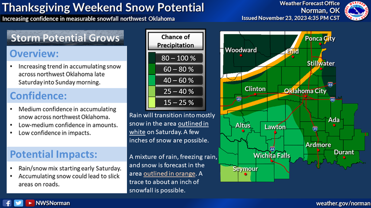
*The bottom falls out on Saturday as previously stated in past posts. Snow is expected in NW Oklahoma and we might see a mix of snow and freezing rain. Impacts here would be on bridges and overpasses to start with and then we’ll see how this mess tracks. Wind chill temps will be brutal later on Saturday evening and especially Sunday and Monday.
*As stated yesterday, if you plan on traveling west or NW, check with the closest NWS office for the latest updates. A WINTER WEATHER ADVISORY has been issued for Harper, Woods, Alfalfa Grant, Ellis, Woodward, Major, Roger Mills, and Dewey counties. It begins at midnight tonight until 6 am Sunday morning. Expansion of this advisory may occur depending on the track of the storm system. We’ll see what happens.
*Overall, we’ll be ok so here is your forecast from the NWS/NORMAN;
Today- Mostly cloudy this morning, then clearing. Much cooler with highs in the mid-40s. Northeast winds 10 to 15 mph with gusts up to 25 mph.
Tonight- Mostly clear in the evening, then becoming mostly cloudy. Cold with lows in the mid-20s. Northeast winds 5 to 10 mph.
HAVE A GOOD DAY!